Prologue
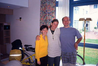
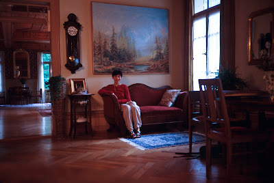
On the night of July 1st, Lisa and I flew from San Francisco to Munich for a tour of Europe. We arrived at 5:30pm on July 2nd, and managed to miss a connection with our hosts in Munich. We did manage to find our hotel, however, and slept badly because of jet-lag. The next morning, our hosts (Kerstin Fischer and Beine Heinz) arrived at our hotel to pick up our suitcase for safe-keeping. It had threatened to rain the night before and started raining in the morning as we were having breakfast.
 |
| From Tour of the Alps 2003 |
July 3rd, 2003
(Munich, DE to Marnau, DE, 63km)
We left Hotel Movenpick at 11:00am during a spurt of rain. The tandem handled well, but the shifting was iffy in a few gears. The derailleur hanger had been bent under transport, and I had bent it back so that it indexed well under easy conditions, but with both our weight and the panniers on the bike, it did not do so well.
Nevertheless, the ride to the train station at Hallbergmoos was flat and easy, and the rain stopped as we rolled into the S-Bahn station. There, we boarded the train which took us to the central station, where a quick switch got us to the Starnberg station. We should have gotten off in N. Starnberg, but it turned out that the Starnberg station was right next to a bike shop. Their mechanic was away, but the woman at the shop directed us to another shop a few blocks away, where for 5 Euros the mechanic (a boy of no more than 16 years) used the Park Tool designed expressedly for that purpose to straighten our derailleur hanger, and then re-adjusted the indexing so skillfully and quickly that I had no doubt that he had done this before. (The shop’s mechanics also spoke English, and in any case all we had to do was to point at the derailleur hanger and they knew what was up)
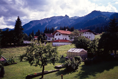
I had originally planned on this day to ride from Munich to Garmisch-Partenkirchen, the site of Hitler’s Olympic games. But our combined jet-lag, the poor supper the night before, and the advice of our hosts made me re-adjust our goal to Marnau for the day. According to them, Marnau was nice, as close to Oberau as Garmisch would be, and offered reasonable lodging as well as much less riding.
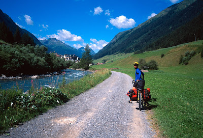
By the time we seriously got started, it was 1:00pm. We went off to find our wy to the Eastern shore of Lake Starnberg, where we found the bike trail described in Tour #4 of “Germany by Bike.” The actual route description runs vague, but the route itself was easy to follow once we found it, taking us through a combination of trails, pavement, gravel roads, and once, a stair case that required a little portage. The lakeshore was beautiful, however, filled with trees and small houses, and next to no traffic, so I did not begrudge the dirt. I was mostly happy to simply be riding at last, and the vaguely threatening weather ensured that the trails were none too crowded with pedestrians.
 |
| From Tour of the Alps 2003 |
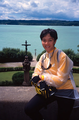
The chain did start squeaking a bit from the morning rains, so I stopped to put oil on it. After that, the bike path turned into a trail that at downhill speeds, was sketchy enough to make me slide around a bit when I braked, almost to the point that had me wishing for knobby tires. We did arrive at a small chapel by the trail side, however, and after walking around it saw the monument (a cross in the water) that marked King Ludwig’s death.
King Ludwig was known as the Mad King of Bavaria, because he was declared insane by his advisors after spending an enormous amount of money on his fantasy castles. He was also known to be a strong swimmer, but allegedly drowned in this shallow part of the lake along with his doctor. Perhaps there was foul play involved, but we’ll never know.
From the monument, the trail quickly gave way to pavement, and then a road with pointers to Seeshaupt, where a bakery and supermarket invited us to linger and eat. The weather improved as we made our way south to Iffeldorf and Antdorf, where we met some cycle tourists, one of which tried to give us directions for a quieter route to Marnau. However, after we tried exploring his route and found none of the pointers that he described, we ended up taking the main road, which had quite a bit of traffic.
It was hence rather late when we entered Marnau, where we discovered that the tourist information center was closed and the obvious hotel in the center of town charging 100 Euros. Having no choice, we accepted the price and after a hearty dinner, slept well, waking up having gotten over most of our jet-lag.
July 4th
(Marnau, DE to Fussen, DE, 90km, 780m elevation gain)
We had a filling breakfast at 7:30am and headed off into overcast skies by 8:30am. Going South from Marnau, we found a bike route that took us off-pavement once more. After a bit of gravel riding in the woods I soon tired of it and found a way back onto the main road, which was quite deserted. As with other places in Europe, we had discovered that the main road is easier to follow, shorter, and faster if you were in a hurry or just didn’t want to deal with the navigational hassles.
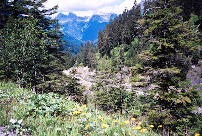
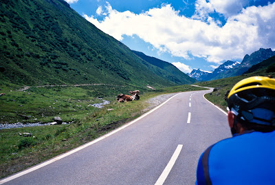
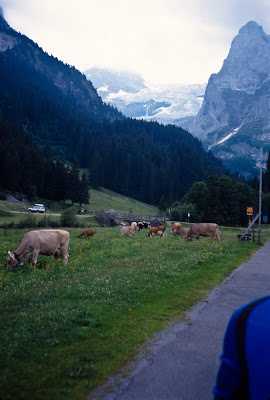
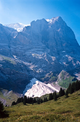
At Eschenlohe, however, we found a tunnel with a “no bikes” symbol that forced us to turn around and stop at the tourist information center in town. There, we were informed of a bicycle route around the tunnel all the way to Oberau, starting in Wengen. We were also informed that we could not make reservations in Fussen from here, since the tourist information centers were not networked and generally only handled booking for the town itself. The route looked interesting, so we decided to have a look. At the end of town, the pavement ended within a kilometer and a fire road started. As the trail crested a short hill, we heard for the first time the tinkling of cow bells. All around us, the hills, forest and streams looked like something out of a movie—one might expect Julie Andrews to come out from one of the barns and start singing. Lisa was delighted and immediately asked for a photo.
 |
| From Tour of the Alps 2003 |
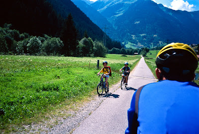
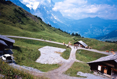
We rolled along, stopping to put on rain gear as we started to feel drops on our faces. The trail was somewhat wet but well packed, so we did not have any trouble making progress, though the going was slow enough that we did not have any splash from the wheels. After we reached a golf-course, the dirt turned into pavement and the bike route signs disappeared. We had arrived at Oberau, a small tourist town whose tourist information center gave us directions to Ettal.
There’s only one road to Ettal, which was our first substantial climb. It turned out to be no trouble at all, as the rain stopped early on, and we rode into Ettal relatively dry. Past Ettal, we picked up the gravel bike path to Oberagammau (where you have to read the directions in the book rather carefully as the bike route’s signs lie!). We stopped in Oberagammau for a standing lunch before searching for the bike trail to Graswang and Linderhof. The directions in the book turned out to be excessively vague, but after a complete circuit in and out of town we found the quiet road described (future visitors: ride towards the main road from town, cross over the river and immediately turn left onto the difficult-to-find bike path entrance) and rode towards Linderhof.
By this time, the rain had resumed, along with a slight headwind. To make it worse, the road to Linderhof was a very gentle grade, which caused our speed to be subtly slower, but was not otherwise discernible (I had cleverly hidden my altimeter under my route sheet, a mistake I would not repeat the rest of the ride). Lisa was unhappy about both our pace and the rain, and worried about our ability to make Fussen before the tourist information office closed. The road, however, was so quiet and empty that we could ignore the bike route signs pointing to Linderhof.
 |
| From Tour of the Alps 2003 |
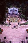
We arrived at Linderhof at 1:00pm, wet and eager for a respite from the rain. We parked the bike at the empty outdoor dining area underneath some tents, and then toured the grounds before our castle tour was scheduled. Linderhof was actually the castle that Ludwig spent most of his time at. Modeled after the Versailles palaces of the French Sun-King Louis the XIV, the grounds were opulent: filled with gold trimmings, fountains, and grand stair cases. The actual castle itself, however, was under some sort of renovations, though, which made the grounds less impressive than it otherwise would have been.
The actual castle tour was revealing of Ludwig’s life—he lived alone, never married, and though Linderhof had audience halls, reception areas, and so on (having been modeled after the Sun King’s domicile), he was such a shy man that he never held audience, and had dinner brought to him through a mechanical pulley system so he didn’t have to see his servants.
By the time we finished the tour, the sun had come out and we were able to get going again in comfort. Now that we knew that it was a climb, the next 7 miles into Austria (note the lack of border controls) went by quickly. Our entry into Austria led right into a steeper climb, which was no big deal as even from that bottom we could see that it could not be long, and we were sick of gentle grades that were demoralizing. Once at the top, however, the slogging stopped and the soaring started.
The descent to the Plansee (all lakes were called “See”s) was glorious, with the lake rising up to meet us at 71.1kph, our second fastest speed on the entire tour, though we did not know it at the time. The ride along the blue waters of the Plansee was similarly satisfying, as we could keep a speed greater than 30kph at all times and could easily stay with the cars.
Before we knew it, we were in Reutte, and heading through Pflach, and then going up at 10% grade (signed for 12%) into OberPinswang, heading into Germany. It was now a pleasant afternoon and the grade between here and Fussen slowed us down very little, since the descent was very fast and quite safe.
We rolled past the Lechfalls, and then into Fussen town center where we arrived at the tourist information center a little past 4:30pm, where we found a listing of guest houses. We settled at the Peters Gausthaus at 50 Euros including breakfast, a short distance from the town center where we had a pleasant dinner.
July 5th
(Fussen, DE to Wangle, AU, 53km, 470m)
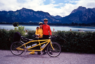
We ate an early breakfast at 7:00am, and were on the road (sans panniers) by 7:45, since we wanted to get to Neuschwanstein before the weekend crowds at 8:00am. We took a wrong turn to Schwangau when we should have turned towards Hohenschwangau before we set ourselves right. This turned out to be a blessing in disguise however, since it got us great views of Neuschwanstein from afar, and we still arrived at the booking office at 8:00am with no one in sight but a few agents. Rain had begun to set in, but I discovered that smooth Avocet Fasgrip tires don’t throw up very much water (and what little that was thrown up was blocked by the oversized aluminum down tube) , and as previously experienced, the trunk bag did a great job of keeping the water away from Lisa’s back and neck.
We bought tickets for both Neuschwanstein & Hohenschwangau, since the package deal was cheap and Lisa had not been to Hohenschwangau. After a little time, the rain died down slightly and we started up the road to Neuschwanstein. The Santana tour catalog proudly boasts of a charter bus that carries you up the 13-15% grade (a 5 Euro value), but in the morning with no one to share the road with the climb was very pleasant, especially since the effort warmed us up and we were without panniers. The two tourists who were walking up the hill were impressed and stopped to chat with us.
 |
| From Tour of the Alps 2003 |
Ignoring the bike path signs leading to a steep dirt trail, we reached the castle entrance and rolled through the front gates and locked up the tandem. We walked the grounds and exchanged pictures with a few other tourists, including a Taiwanese tour group that arrived by bus after we did.
The first tour in English started at 9:15am, and by that time the queue lines had started to fill. The tour guide did say, however, that this was an unusually small crowd, probably because of the rain and early time. King Ludwig died while the castle was still incomplete, so most of the rooms are still unfurnished and therefore not in the tour. The rooms that were finished, however, were quite impressive. Each room was painted with scenes from various Wagnerian operas, and if you asked the tour guide he was quite capable of identifying all of them. Appropriately enough, all of the operas had a tragic ending, as did Ludwig himself. Neuschwanstein, by the way, was Walt Disney’s inspiration for the castle in the movie “Snow White.”
The two-tour schedule was such that a walker could make one tour after the other, which meant that a tandem team could easily make side trips. After our Neuschwanstein tour, we rode up to the bridge where most pictures of Neuschwanstein was taken, maneuvering our way between crowds of tourists. The views were impressive, and the grades suitable for an unloaded tandem. We then rolled down the previously-ignored bike path to get us to the bottom of the hill. Fortuitously enough, the rain returned just in time to cool our rims as we descended to Hohenschwangau. We couldn’t find a good place to lock the bike, but the parking lot attendant was happy enough to keep an eye on it for us while we toured, and I tipped him appropriately when we returned.
Hohenschwangau had a much more lived in look and feel, and we got to see the separate King & Queen’s bedrooms, which were connected via a hidden staircase (used at least twice, since they had two progenies). Ludwig’s younger brother actually did go mad, long before Ludwig was himself declared mad, and so was unfit to rule after Ludwig died, so their uncle became Regent.
After the tour of both castles we were both quite hungry, and went back to town for a self-serve buffet lunch at the location of “Ludwig the Musical.” There, a Japanese couple that Lisa had run into earlier joined us and we had an opportunity to practice our Japanese in Germany, of all places. By the time lunch was over, it was close to 2:00pm and we returned to the guest house to pick up our panniers. We rode back over to Austria & Reutte in time for the sun to come out, and in Reutte I mde the mistake of choosing to head towards Heiterwang, rather than down towards Hahntennjoch, thinking that skipping the pass would save us time. The short climb into Heiterwang, however, convinced me that this choice of route was an utter mistake—the traffic was exceedingly heavy, and the scenery wasn’t at all good.
At Heiterwang, therefore, we got off the highway and headed up the hill to the train station, hoping to find a train to Imst or the environs. There, we found a young lady working in Heiterwang waiting to take the train to Reutte who patiently with the help of our map and dictionary explained that there was no train to Imst in this direction. She did say that the train back to Reutte would only cost a few Euros, and upon further consideration I decided that my original plan of riding the Hahntennjoch pass was a much better plan than trying to bypass the hills, so we joined her on the trip back to Reutte after sharing some chocolate with her. The train did indeed cost but 3 Euros for us and the bike, and we arrived in Reutte without much further ado.
The time being 5:30pm, we decided that staying in or Reutte would be a good idea. The tourist information center was closed, but outside it was an internet kiosk homed in on Reutte’s website. With a combination of the local map and the kiosk, we quickly found a B&B run by Marianne Singer in the appropriate direction and for what we considered a good price. We lost no time riding there, and soon found ourselves standing at the door of a house in Wangle on the outskirst of town. I rang the doorbell while a dog ran out to bark at us, and moments later a woman shouted at the dog while opening the door. “Zimmer frei fur zwei?” I asked. “Ja, Ja!” She said. We had found a night’s stay and breakfast for 40 Euros.
 |
| From Tour of the Alps 2003 |
We were her only guests, and got the top floor suite with a grand view of the Austrian foothills. This was the classic European Alpine views that I had come for, and I was delighted both at the price and the landscape. Dinner was at a local restaurant just around the corner, which while serviceable for me wasn’t so great for Lisa. A ride into town for dinner might be better for future visits.
July 6th
(Wangle, AU to Landeck, AU, 85km, 1555m)
With breakfast served at 7:30, we managed to hit the road at 8:30, this time with Cytomax in our water bottles, since we knew there was going to be a big climb that day. Heading South towards Hahntennjoch, we soon found a bike path following the river next to the road. The views from the bike path were superb, but without knowledge of local geography, we found ourselves stopping at Weissenbach and asking local cyclists, who were fortunately very helpful. Just after Weissenbach, we reached a strange intersection where the bike route pointers actually went north! We confirmed that this was indeed the proper route by asking a couple on mountain bikes, and then headed in the directions pointed, which rapidly went from pavement to dirt.
 |
| From Tour of the Alps 2003 |
Forget everything you know about bike path and bike routes anywhere else. The bike path from Weissenbach to Stanzach and Vorderhornbach is the platonic ideal for a bike path. Composed of a mixture of dirt, gravel, and an occasional meter or two of pavement, this was by far the most beautiful ride I had ever done on a designated bike path. We passed some farmland, climbed a few hills for great views of the river, and then reached some woods along meandering streams, flanked by meadows full of blooming flowers. It was like riding through the high country of Yellowstone National Park (which is closed to cyclists). The sights, smells, and the mixture of warm and cool air as we went from one zone to another overwhelmed our senses as we rode through this wonderland. If you ever find yourself in the area, you must ride this bike path. It is well worth practicing off-road riding just for this ride. It’s not terribly technical, but you should have a level of comfort with trail riding that many road riders never achieve. I wished that it would go on forever, but after 10km, it finally stopped near Voderhornbach, where we found a quiet route to Martinau, and then turned back onto the highway to Elmen, the foot of the Hahntennjoch climb.
 |
| From Tour of the Alps 2003 |
Hahntennjoch goes from 976m in Elmen to a height of 1908m at the top. Not having either the OCD guide or Jobst’s ride reports to help me, I did not know what to expect. Future travelers would do well to avoid my mistake and not attempt Hahntennjoch on a weekend. While the traffic didn’t bother me, being roughly the same as Highway 9 on a busy weekend, the road was much narrower, and large tour busses and packs of motorcyclists came by very frequently, taking quite a toll on Lisa’s emotional state. After an initial steep stretch, the road leveled off and we encountered our first tunnel. We had to put on our lights for the first time. After one more tunnel, the grade eased even further and we found ourselves in the town of Bschlabs, where we stopped for a drink.
Past Boden, (the next town) the road resumed its climb at a grade of 12%, and the views got dramatically better. In the few quiet moments, we could also hear cowbells ringing away in the distance. As the climb proceeded relentlessly, I discovered to my dismay that on the loaded bike, I could not stand up on a grade this steep without excessive strain on my shoulders, so while Lisa could stand as she pleased, I could not. Some serious weight training might be in order before the next mountain trip.
We passed cascading streams, mountain huts, and other roadside distractions until finally, we crested the hill where we exchanged photos with another cycling couple, and gazed at the surrounding mountains while the mountain wind cooled our bodies. When we had cooled enough we headed down the hill.
 |
| From Tour of the Alps 2003 |
Hahntennjoch starts a 15km descent at 9% grade. I’ve descended 9% grades before, but those were previously short stretches that required frequent braking. Hahntennjoch on the Imst side near the top is a long steady gradient with no serious corners which felt more like skydiving than like bicycling! With the high traffic density, I tried to keep the speed under control, but even then, we still reached speeds high enough to cause air to force itself around my shades to cause my eyes to tear up. We eventually hit a few corners which forced us to slow down as we passed forests and one or two dining places. I had no idea that a descent could stay so steep for so long! We soon saw the city limit sign for Imst and I prayed for some relief from the unrelenting grade. I should have paid more attention to the map, since near and in the town of Imst the grade actually steepened to 15% as the road narrowed and became winding city streets! I braked hard again and again until we finally reached the tourist information center and stopped.
I shivered for a few seconds, and then we looked at the city map for a way to Landeck before having lunch. There weren’t many places opened on a Sunday afternoon, so we ended up with a rather unsatisfying place of spaghetti. We then headed towards the Inn river looking for bike route signs. The obvious signs led us through some construction, and then finally a river-rafting put-in with a sign to the train station and a bike rental business, something I recognized from Jobst’s trip reports. The bike business owner confirmed my suspicion that this was the bike path to Landeck and graciously let us use his restrooms.
 |
| From Tour of the Alps 2003 |
We then went on down the bike path next to the Inn river, avoiding the highway traffic. On the bike path, we ran into the couple we met earlier on the top of Hahntennjoch, and we asked if they would like to ride with us while we chatted. We rode with them for a couple of kilometers until we had to stop to put a fresh roll of film in the camera. After that, we lost sight of our friends and never saw them again. Unfortunately, the bike path was blocked just before Starkenbach due to construction (something that never happens to the main roads, which would have detailed detour signs all over), and we were forced to make an exit in town, where a family told us that it would be best to just take the car-route to Zams and then Landeck. We did just that, and fortunately it was a downhill course, as we were forced to ride through a few tunnels at high speed before finally arriving at Zams and then Landeck.
A quick aside about tunnels—the reason to bring lights on a summer tour of the Alps is not because of night riding (it stays light till 9:30pm, and we didn’t do any on the entire trip), but because of the mountain tunnels. While many tunnels had bypasses that included some pre-tunnel roads, some simply had no alternative. Whereas many Swiss tunnels are lighted, other countries don’t necessarily believe in lighting tunnels. While many cyclists we saw rode those tunnels without lights, I can’t imagine that this as being safe. You don’t need terribly powerful lights, and the battery powered cateye LEDs should work well enough.
Landeck, like many other towns spanning the Inn river, is a maze of bridges over the tunnel and steep roads leading up to the nearby hills—it is so hilly that the city has no way to expand but to build on the hills. We stopped at the train station to get lodging information, identified a likely candidate on the other side of the river, and then rode to the area. Unfortunately, we found the house numbers were non-sequential and in no apparent order, so we could not find the B&B. There was another guest house in the area, however, and we took the opportunity to inquire there instead.
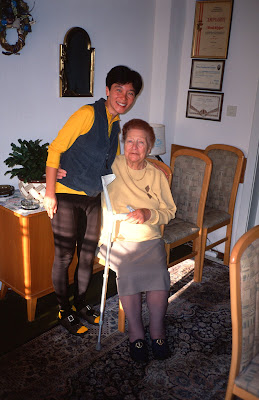
It was an interesting place, a house with about 4 floors. The apparent owner, a lady of perhaps 80 years, was not very mobile and so employed different helpers on different days. She wanted to keep our passports so we couldn’t flee without paying, but not trusting the strange setup, we paid in advance instead.
 |
| From Tour of the Alps 2003 |
Dinner at Landeck was at a hotel a bridge away via a pedestrian path past a park where we saw a couple make out unembarrassed. Dinner was excellent, and we had ice-cream outside where a band had gathered, apparently waiting to play. We ate our ice-cream while they played one song, and then gasped in surprise as the band got up and proceeded to spend the next hour chatting and drinking beer!
I asked the restaurant manager about the route to Silvretta, and he told me to look for signs to Pians, and then we headed back to our B&B. I mentioned to Lisa that I was disappointed by the small number of cycle-tourists that I’d seen so far. “I would have thought that we’d have seen more of them than we have by now.”
July 7th
(Landeck, AU to Bludenz, AU, 100km, 1570m)
Well, at breakfast we were joined by 2 young women who were none other than cycle-tourists! They had come down from St. Anton, and were on their way to Italy. They had apparently arrived later last night and had negotiated directly with the owner. Breakfast was the usual platter of cold meats, breads, butter, and jam.
It was good that they were with us, since after breakfast the owner wanted us to pay! We insisted repeatedly, both to her and to the assistant of the day that we had paid yesterday, and thanks to the help of the Austrian girls, we got through to them. Nevertheless, we didn’t try to linger to see if they’d try to charge us again.
The ride out of town as flat, but once we got to Pians, the road started going up and we stripped off our leg warmers as we got to the Silvretta turn off. Naturally, once we did then, we discovered that the Silvretta road descended rapidly down to the Trisanna river, chilling us repeatedly as we dove in and out of the tree-shadows. Since it was going to warm up as we climbed, we did not bother putting on warm clothing again.
It stayed pleasantly cool as we hit the one moderately long tunnel/slide protection gallery along the gently rising portion of the climb up the Silvretta. This was just as well, since while trying to turn off the rear light on the move after that tunnel, we dropped the much-abused vista-light and broke it. We rolled along gently, enjoying the beautiful Austrian towns that lay along the river. Just before Ischgl, there was another series of tunnels but this time, a bike route was appropriately signed around the tunnel as a bypass. We stopped in Ischgl to use a public toilet, and then headed up the hill along a bike path that we quickly abandoned after it became apparent that it was more for mountain biking than for road bikes.
 |
| From Tour of the Alps 2003 |
At Galtur, the start of the real climb up Silvretta, we stopped for a grocery store lunch. On our way out of town, however, we ran across an outdoor shop and proceeded to buy a replacement tail-light. At 7 Euros, this light would last until the end of the trip, when the activation mechanism would fall off.
There’s a tollbooth for Silvretta right outside Galtur, but cyclists get to ride the road for free. Past that toll booth, Silvretta turned out to be an easy, pleasant climb with relatively little traffic (especially on a Monday—what a difference a day makes!). The mountain scenery was beautiful, and the road swept around mountain streams with the ring of cowbells close to us, a scene now etched into our memory. The road does get steeper near the summit, but not too much, and after a little bit more effort we reached the top where there was a dam providing hydropower, as well as a café complete with parking lot and tour buses. There, we bought soup and bread and ate outside, enjoying the cool air. We parked the tandem next to the sign explaining the multi-reservoir system on the mountain, drawing much attention from the motorcyclists who were also parked in the same general area.
 |
| From Tour of the Alps 2003 |
After that snack stop, we used the rest rooms, put on our jackets, and prepared for a furious descent, as Jobst mentioned the 32 numbered turns on the Bludenz side. The initial drop turned out to be fairly gentle as we made our way past the second and third dams, but soon the numbered turns began in earnest! Not every one of these turns were hairpins, but a goodly number of them were as the road wove back and forth rapidly between cascading waterfalls and valley vistas, one after another in rapid succession as the air temperature rose rapidly climbing at least a half degree (Fahrenheit) every kilometer. We stopped early on for some pictures but after a few hairpins that had me braking almost to a stop at each corner a wild fury overtook me and I decided not to stop until the stones numbering the turns had counted down to 1 and there was nothing left to do. I must have done really well, as no one passed me until turn #4, when a motorcyclist pulled up next to me and gave me a thumbs-up signal before gunning his engine and pulling away. We topped out at 69.5kph on the descent, as a combination of frequent corners and a stiff headwind impeded us. (It would turn out that none of the other descents we were to do would beat Hahntennjoch for sheer scary-factor—certainly, none of the other descents would prompt me to reconsider my decision about not bringing a drum brake, while Hahntennjoch did do so—for 3 seconds)
 |
| From Tour of the Alps 2003 |
Once in the town of Partennen I saw a bike route sign and pulled off the main road, but saw no sign of one. There was, however, an open supermarket, so after we shed our excess clothing Lisa went in to do some grocery shopping. I pulled out my map to look at the next few towns while a man walked by. He saw me looking at my map and asked where we were going. I said “Blun-dez”, and he said, “Blue-denz.” He then pointed down the supermarket parking lot and said, “that bike route takes you all the ay to Bludenz.” After making certain that it was the parking lot he meant, I thanked him.
After Lisa was done with our groceries, I told her about the encounter and we headed off down the bike path, which followed along the Klostlertaller Bach. This bike path not only sheltered us from the headwind (which admittedly usually dies down as you descend into a valley anyway), but also provided a gentle downgrade to Goschurn, St. Gallenkirch, Scruns (where we would have to walk around some construction), Vandans (where we got a little lost), and finally Bludenz.
As we followed the bike path through meadows of flowers, over bridges (even a few bike-dedicated covered bridges!), and past towns we giggled to ourselves wondering when this ridiculously long downhill would end, but it never did! (Looking at the map, I can see why—Bludenz was at 588m in elevation while Partenen was at 1051m, an elevation loss of at least 1500’—in other words, from the top of Silvretta, you can easily have 80km or so of descent all the way to Feldkirch)
 |
| From Tour of the Alps 2003 |
At Bludenz, we stopped at the tourist information center, where we found a B&B for 46 Euros a night, hosted by a former Chef who worked in Canada for 10 years to pay for her house here. The house turned out to be a four-plex which could be rented out for either a long stay or to tourists, so our 46 Euros got us an entire second floor apartment (kitchen, living room, balcony over looking the garden, and bathroom) all to ourselves. I was impressed.
As I locked up the bike in the rear porch of the house, a pretty young woman in a mini-dress said to me, “This area is really safe, you don’t really have to lock it up!” I got over my surprise at hearing English, and thought to myself, “This must be the daugter of the house.” Then I responded, “But I’ll sleep better at night having locked it up!” She laughed and told me, “You can move it further in if you like, to get it out of the rain.” “Will it rain tonight?” “No.” “In that case I won’t bother.” “So you’re only staying for the night?” We chatted further, and it turned out that Andrea and her boyfriend Frank were tenants in the downstairs apartment. Frank worked as an engineer at the chocolate factory in Bludenz, a place we’d wanted to visit as we missed the chocolate festival by a day! Andrea invited us to come over after dinner when Frank would be home for more conversation.
 |
| From Tour of the Alps 2003 |
Dinner was at a local restaurant recommended by our B&B hostess, a place whose exterior so resembled a fast-food restaurant that we walked past it once thinking that it must be some other building. The food, however, turned out to be delicious.
After dinner, we took up Frank and Andrea’s invitation, and sat down to good Austrian soda and a heap of chocolate that Frank brought from the chocolate factory, and wonderful conversation about the cost of living in Austria, the USA, and lifestyles in general. Andrea was a marketing person for an American chemical/pharmaceutical concern with a branch in Buchs, Switzerland just across the border. They’d set up their lives so neither had to drive to work, and seemed very happy with their lives.
After a late night, we turned in reluctantly and slept easily, having had yet another packed day.
July 8th
(Bludenz, AU to Marienfeld, CH, train transfer to Ilanz, 80km, 400m)
Our hostess stayed up the night before making jam so we could have home made jam for breakfast! It was the usual Austrian breakfast fare otherwise, but that jam was definitely the high point.
Lisa wanted to do some shopping, I wanted to do some shipping of now useless maps back to our hosts in Munich, as well as some items brought over for friends in Switzerland. But first things first—the rear wheel had developed a slight wobble, and rather than true it myself, I took it down to the local neighborhood shop for work. The local shop was strange, as it sold scooters as well as other household appliances as well as bicycles. The mechanic’s shop was well equipped though. The mechanic first tried to convince me that the tire was worn out because they were bald, but after pointing to our front tire (still obviously brand new), he finally realized that Avocets came without tread patterns and then proceeded to true the wheel while I went off to do my business.
 |
| From Tour of the Alps 2003 |
By the time we got everything done, it was 10:30 when we once again proceeded down that wonderful bike path, continuing on that wonderful downhill from the day before. While we got lost a couple of times on Monday, today was worse, as the bike path and various route signs were nearly a maze. We did eventually link up with a German cycle tourist who only called himself “Yukie.” He’d obviously been on the road for a long time—his equipment was old and well used, and he knew the local combination of bike paths and roads like the back of his hand, carefully choosing when to be on the bike path and when to be on the road because one or the other was shorter or was better suited to our purposes. Because of his expertise, we were soon in Feldkirch where he took leave of us before we even had a chance to thank him.
Feldkirch was our last stop in Austria, so we had lunch at a deli. Lisa wanted to look for this musical instrument store, but after we hunted unsuccessfully for it for 15 minutes she decided it wasn’t worth the delay and we headed South towards Vaduz into Liechtenstein. The border crossing was uneventful, and we quickly found a tourist information center which told us of a bike path along the Rhein. We took the opportunity to get our passports stamped (for 2 Euros a piece, the only time we ever got our passports stamped while cycling), and rode down to Eschens, where Lisa mailed some postcards.
The indexing on the rear derailleur had started to go stiff on me, so while Lisa was in the post office I took the opportunity to take apart the shifter and re-lubricate the shifter body. That didn’t seem to help much, so I put the shifter into friction mode, which as always functioned perfectly. I had been warned that 9-speed shifting was too sensitive to shift in friction mode, but it was no trouble at all after a 10 minute adjustment period.
It was really cooking by the time I was done, so we ate some ice-cream before proceeding to the bike path East of the Rhein. This bike path follows right along the river on an elevated embankment, and we could see a similar bike path on the other side of the river (the Switzerland side). On level ground, the tandem really flies and we made good time, and soon saw the Prince’s castle in Vaduz in less than 10 minutes. Since this castle was inhabited by a real-live prince, we could not tour it. In Vaduz, we took a covered bike bridge across the Rhein, where at the halfway point I saw symbols indicate that we had finally crossed the border into Switzerland—a country traversed in less than a day.
Feeling full of our achievement, we proceeded South on the Swiss National bike route on the West side of the river. While the terrain around us was hilly enough, the bike path was boringly flat. We made really good time until we got to Flasch, where pointers took us into town before we realized that the easiest bike route never leaves the river. (We were later to find out that the signs we followed were for the mountain biking route)
Once we got to Maienfeld, however, we were stopped cold past the train station, and seeing that it was 5:30pm already, we took the train into Chur. Chur was a busy town, with large buses taking up entire streets blocking traffic for minutes at a time. I got impatient at one point and tried over-taking on the on-coming side but a similarly sized bus started coming down the other way and I was forced to jump a curb into the sidewalk. Despite such attempts, we got to the tourist information center 10 minutes after it had closed, and ended up returning to the train station to call various hotels. After the cheap lodging in Austria and Bavaria, Chur gave us sticker shock. Furthermore, we were getting really bad feelings about staying in town, which seemed rather busy after the quieter smaller towns we had stayed in. We made a snap decision to take the train to Ilanz in the hopes that a smaller town would be cheaper.
 |
| From Tour of the Alps 2003 |
The train to Ilanz also follows the Rhein, but on the opposite shore from the road, and was exceedingly beautiful. By the time we arrived at Ilanz, it was 7:30pm. This time, however, our instincts about small towns paid off. The train station staff had one person, but he was exceedingly helpful (and cute too, according to Lisa). He called around and got us a hotel for 120 Swiss Francs, still expensive, but enough to make us feel like our train trip wasn’t wasted. We rode across town to the hotel and were given a nice room in the top floor of the hotel. Dinner was at the restaurant next door where I had my introduction to Cordon-Bleu, a delectable dish made out of two or more kinds of meat sandwiched with some stuffing or vegetables. It was most filling and I highly recommend trying it. Lisa didn’t have such a good time with her meal, so I took the opportunity to explain to her my Shaolin theory of vegetarian cooking.
That night, we slept like logs, relieved that the heat and bustle of Chur had been replaced with the cool and quiet of an unhurried Swiss village.
July 9th
(Ilanz, CH to Hospental, CH, 70km, 1565m)
 |
| From Tour of the Alps 2003 |
After a breakfast during which we saw two other cycle-touring guests, we headed West along a bike path recommended by the train station staff member the night before. At Rueun, however, the path disappeared and we returned to the road, where we would pick up the bike path now and again. In retrospect, I would not recommend the bike path for this section of the ride. There is a fair bit of gratuitous climbing and descending, and the surface while navigable was none too good. Moreover, the main road is perfectly serviceable and traffic relatively light during the week. On no account should a tandem team on anything but a mountain bike tandem attempt the path past Danis, and even those tandem teams should have knobbies mounted. As it was, we had to walk a few sections, and single cyclists riding loaded mountain bikes on a self-supported tour coming the other way were also observed to walk those sections.
We gave up on the bike path after that and proceeded quickly into Disentis/Muster, where the real climb up to Oberalp pass started. There, we used some public toilets and ate some fruits for lunch, observing a parked tourist bus and hoping that we would not see too many of those today.
That was a needless worry, it turned out, since not only was the traffic light, Oberalp turned out to be the easiest Swiss pass we would do. The grade was so easy that we could stay in the middle chain ring much of the way, and we could stand up every so often to power through the slightly steeper sections. Once again, there was a lake at the top as well as a café, but we didn’t stay long, as we were feeling strong and wanted to push on.
After the summit tunnel, the descent from Oberalp was smooth and straight until we got near Andermatt, where a series of hairpins tested our brakes. Lisa evidently had the better view, for she claims that the Oberalp pass was her favorite descent because of the views, while I remember very little of it except the speed and the thrills, and a vague memory of a beautiful distant valley out of the corner of my eyes.
 |
| From Tour of the Alps 2003 |
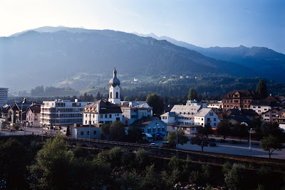
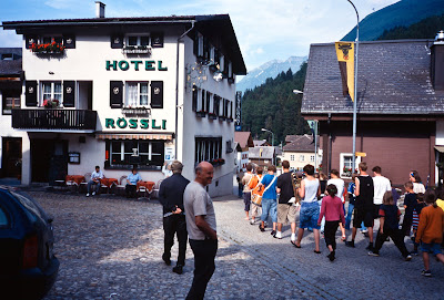
Andermatt was a touristy little town, full of gift shops and hotels, so as recommended by Jobst, we rolled down 3 km to Hospental where we stayed at the Hotel Rossli at the start of the cobbles near the center of town. A warning, though: Hospental has no bancomats, so if you need cash you have to pick it up in Andermatt!
Hotel Rossli gave us a nice room on the second floor with an excellent view of the mountains to the East, a view which I never got tired of. At 100 Swiss Francs a night it was moderately priced. Dinner was fine but Lisa was still unhappy at the vegetarian offerings. It was early in the day (we arrived at 4:30pm, instead of the 5-7pm that we were getting used to arriving at), so we took the time to walk around town and explore the old roman tower on the hill top at the edge of town. As we walked along, we could hear the cry of lambs in the background as well as the ringing of cowbells in the distance.
 |
| From Tour of the Alps 2003 |
At a height of 1336m, Hospental air was fresh and cool, making it easy for us to sleep and rest in preparation for the day ahead.
July 10th
(Hospental, CH, 80km, 2195m)
We were going to be without panniers today, since we were going to attempt Furka, Nufenen, and St. Gottard passes in a day, returning to Hospental.
Breakfast was light and quick, and we rode up the cobblestones at 8:30am to start climbing Furka pass. The road goes right past Realp, a town with a campground and a train station. Once out of town, the road proceeded to gain altitude in a high mountain valley in a series of switchbacks that increasingly gave us better and better views of the valley below, where we could see train tracks and a tunnel for the DFB antique steam-driven train.
 |
| From Tour of the Alps 2003 |
We stopped at the hotel Tiefenbach for a drink, after which the grade leveled out, quickly leading to a summit where we could see the valley, a series of hairpins that was the backside of Grimsel pass. Lisa wanted to see the Rhone glacier up close, so we quickly descended to the glacier parking lot, paid our entry fee, and made the short hike to a tunndel carved into the glacier itself. The tunnel was a dark blue shaft leading into a dripping series of “caves”, with water running underneath planks laid down to serve as a walkway. The chill of the descent combined with the freezing glacier made me shiver despite the late morning summer sun.
 |
| From Tour of the Alps 2003 |
After shopping the gift shop, we descended to Gletsch in a series of fast hair pin turns. Without a load, we were significantly faster on the descent, but the tourist traffic was somewhat heavy and I got stuck behind a few cars. We finally stopped at the restaurant in Gletsch hoping to get lunch, but the waitress was so rude and the service so poor that we left after only having drinks. I would not recommend a stop in Gletsch unless you were simply using the public restrooms next to the hotel.
From Gletsch, the road lead through turn after turn along a river alongside the road, occasionally going through a few short tunnels. I was surprised by how much descent was still left as we headed into Oberwald, where it was now uncomfortably hot. Between Oberwald and Obergestein, the road passes a series of tunnels which we avoided by riding an unpaved fire road which while rough were quite navigable on an unloaded tandem. Once in Urichen, the temperature once again soared, but we were hungry, so we stopped for lunch at an outdoor restaurant where a few other cyclists were gathered.
By the time we left, it was 2:00pm, and I really doubted if we would make all 3 passes that day. The climb up to Nufenen pass was the quietest of all the passes we were to ride on the trip. We saw a car every 10 minutes or so at most, so we were left alone to enjoy the peaceful desolation. The forest, rocks, lonely streams and craggy peaks around us served as a suitable backdrop to the “cowbell concerts” that had by this time insinuated themselves into our psyche—we knew that whenever we heard them we were climbing a mountain pass.
We took a toilet break at a house with an “AlpKase” sign hung outside. “AlpKase” means “mountain cheese”, made from the milk of the roaming mountain cows that we heard all though our trip. We chatted with the family that was selling cheese—it turned out that they were from Portugal for the summer work, taking care of cows while grandma made the AlpKase. When we asked about cowbells they said that the bells were there to make their job easier when they had to chase down a runaway, or find an injured cow. Down in the lowlands where the pastures are now fenced, there was no need for cowbells, and believe it or not some tourists complained about how loud they were, so the practice of putting bells on cows is now fast disappearing in the lowlands. Some day, all cows will have GPS locator tags and cowbells will probably vanish altogether. For me at least, the passing of this tradition will mark a sad day for the mountain cyclist in Europe.
 |
| From Tour of the Alps 2003 |
Past the series of houses, the road takes leave of the stream we’d been riding next to and began to rise steeply and weave back and forth as it gained altitude. But once we felt the cool breeze on our faces we knew that we were within 200 meters of the summit. The surrounding glaciers played peek-a-boo with us around every corner. To get to the summit, however, we had to first ride through a passage lined by ice that had yet to melt, heralding the highest pass with both sides in Switzerland. It was thus 4:00pm when we arrived at the summit sign (2478m), a small lake, and a café. The café was a sharp contrast to the cool mountain air. Inside it, I asked if there was a train in Airolo back to Hospental, and got conflicting answers from 2 people. Well, at worst we would have to climb St. Gottard pass, so we decided to descend into Airolo after having ice-cream and tea.
The descent down Nufenen was fast and twisty, but with the light traffic and excellent sight-lines, I could use both lanes and stay confident about our safety despite our max speed of 77.9kph. Because it was late in the day, we saw no cars coming the other way, and there was only one bus going in the same direction we were—we didn’t see it for too long as we gave it a good head start so we would not be stuck behind it. After Al Acqua, the road straightened out considerably and we maintained our speed at well over 50kph going into Airolo where we found the train station and bought tickets for Hospental.
The train took us through a tunnel under the St. Gottard pass, thoughtfully so that it didn’t spoil any surprise the pass would hold for us, and we had to change trains in Goschenen to a cog-rail road to climb to Andermatt. The cog-rail train was too small for the tandem and an over-zealous conductor chipped a bit of paint off our tandem, but the road between Goschenen and Andermatt was not recommended for cyclists this late in the evening because of the long uphill tunnels and heavy traffic.
Upon disembarking in Andermatt, we met a young cycle-touring couple who were carrying sleeping bags but when I suggested the campground we saw earlier in Realp they told me they weren’t camping. Further inquiries revealed that they were using a network of farms/barns called “sleep in wheat” that offered a place in the hay (and as clean a barn as you can ask for) as well as breakfast at a low price (at most 30 Swiss Francs a person). We were not equipped for such travel and wanted a private room most of the time anyway, but certainly a sleeping bag wouldn’t be that heavy and it would be a great way to meet people as well as travel cheaply.
We rode to Hospental again, dropped the tandem off at the Hotel Rossli, and ate at another Hotel/Restaurant up the street. I confirmed with our waiter that riding down through Goschenen wouldn’t be a problem the next morning.
July 11th
(Hospental, CH to Rosenlaui, CH, 72km, 2030m)
This morning once again saw us packing panniers onto the tandem and then cycling up the cobblestone main street of Hospental, this time heading towards Andermatt at the end of the cobbles. The road towards Goschenen starts down a series of slide protection galleries and tunnels that quickly became the most dramatic series of drop-offs and road construction that I had ever seen. From high above, we could look down into curves and whorls made out of a dizzying mixture of roads, tunnels and slide protection galleries that spiraled around like an M.C. Escher painting. I half-expected the whole mess to start moving like a train set or collapse under its own mass. Cycling through this stretch, I was grateful for the light morning traffic and the down grade—cyclists coming the other way had no such luck, since the narrow tunnels and slide protection galleries could not help but make one nervous, despite the general competence and consideration of the Swiss motorist.
Past Goschenen, we left the main road with its spirals behind, and followed the signs to the start of the Sustens climb. Of all the passes we visited on this trip, Sustens was for me the most worthy of praise. It started with a series of switchbacks to rapidly gain altitude, giving us outstanding views of the surrounding valley. The road’s tunnels were short and naturally lit. After this first initial section the road then wound lazily and gently around a green valley following a mountain stream. Each curve revealed a new mountain, glacier, or village previously unseen. Approaching the top, flattish hairpins punctuated steep sections that pummeled our legs and lungs, causing us to breath hard and etching lines of strain into our muscles until finally we rode into a longish dark tunnel and emerged onto the other side to discover the summit, seeing the world again as one newly born, the pilgrim having attained his destination or the monk reaching enlightenment.
There should be poems, epics, and books of photographs devoted to Sustens pass for words alone could not describe the feeling I found that summer morning, contemplating the glaciers, snow, and peaks surrounding us.
 |
| From Tour of the Alps 2003 |
We ate a little, took photographs, and then started the descent. From a lofty height of 2224m, the road descends to a mere 625m in Innertkirchen in a series of hairpins, dips, short tunnels and open space providing vistas of cascades and snake-like road curves. As we made the descent, we felt spray from road side waterfalls, drops of water dripping on us from tunnel roof tops, and the kind of exhilaration that one only feels on a road so perfectly engineered that the only limits are one’s abilities, not the surface, traffic, or camber. If Hahntennjoch was like sky-diving, then Sustens was like soaring with the birds, free as a sparrow and as swift as an eagle. We stopped once for photographs, once for a restroom break, and finally in Innertkirchen, at the very bottom of the descent, but even without the stops the descents would have taken more than half an hour. We reached a top speed of 69.8kph.
 |
| From Tour of the Alps 2003 |
In Innertkirchen, we stopped to get cash from the bancomart and to ask if there was a bike path to Meiringen, but there wasn’t one. Riding out of Innertkirchen, we found a small climb on the way to Meiringen, and as we made the climb I counted the switchbacks and realized near the top from Jobst’s trip reports that this was Kirchet pass, the top of which held an intersection from which a road would lead us to Rosenlaui. Indeed, we found right opposite the Lammi restaurant and past a gas station, a left turn was signed for Rosenlaui.
Jobst describes the climb to Rosenlaui as being “no trifle.” Well, Jobst is a man of many under-statements and to attempt this road on a tandem after climbing Sustens required a captain with no trifle amounts of foolishness. The road was steep (estimated at 13-15%, but perhaps more), and Lisa started complaining. Just before Reichenbach falls (the famous falls which Sir Arthur Conan Doyle used as the backdrop for Moriarty and Holmes’ fictional struggle to the death), she finally burst out, “Why are we scheduling so much climbing? My name is not Jobst!”
Fortunately, the falls were close by and after we hiked down to see it, Lisa had rested sufficiently to go on. I explained that the next day would be a short ride and we’d get plenty of rest. Just above the falls we saw the newly rebuilt Hotel Zwirgi (newly opened just a month ago in June), offering rooms for 180 Swiss Francs a night, including a limited dinner and breakfast. When the manager saw the look on our faces she quickly offered a different room for 20 Swiss Francs less but we were hardly tempted. She then told us that we would have to push on to Rosenlaui, as the Kaltenbach hotel had no rooms free.
 |
| From Tour of the Alps 2003 |
Undeterred, we pushed on. Whether the grade had become more gentle or we had become more inured to the pain I don’t know, but we only had to rest one more time. Despite Jobst’s assertion that there was a steep grade just after Kaltenbach, our gearing was so low that we felt no difference in speed. By the way, Jobst mentioned last year that the road was still unpaved but we saw no unpaved sections on this road (also known as Grosse Scheidegg).
Finally, the road leveled off in the Rosenlaui valley, but not before giving us the best views we would see of the Rosenlaui glacier. It was, however, another kilometer or so before we reached the Hotel, so Lisa was rapidly running out of patience by the time we got there. The Hotel had only one room left at 160 Swiss Francs, but we were happy to pay for that when we heard that the cost included an elegant 4 course dinner and breakfast the next day. At dinner, we were told that the hotel was 100 years old in the newer parts, and 150 years old in the older section by the hostess. There had been a hotel in Rosenlaui since 1797. It was old-fashioned charming, and dinner was everything a hungry cyclist could ask for. I could definitely see why Jobst made it his first stop on tour every year. Of course, we were fool-hardy to arrive on a Friday night without a reservation, so for future tourists, here is the phone #: 033-971-29-12, or welcome@rosenlaui.ch.
 |
| From Tour of the Alps 2003 |
That night, before we went to bed, we made reservations at a budget hotel in Grindelwald (I had picked up a catalog of budget hotels at the top of Nufenen pass), since it was a Saturday and tourists would ensure that the town’s hotels would fill up quickly.
July 12th
(Rosenlaui, CH to Grindelwald, CH, 18km, 625m)
Despite the hearty meal the night before, we still woke up hungry, and the short walk outside the Hotel to stare at the river and the bridges only served to pique our appetite. Fortunately, breakfast was huge, and both of us went for multiple servings of bread, juice, and grabbed some fruit for the road on the way out to supplement what was in our trunk bag. Our tandem was parked in the wine cellar (“Hopefully it does not drink,” said our hostess last night), and we had a good time joking about how it wouldn’t be able to ride a straight line after a night there.
 |
| From Tour of the Alps 2003 |
After a few photographs, we rode off, and the road immediately resumed its steep climb. A pair of women runners were running up the trail, and to my chagrin, over-took us up the hill. As soon as the road flattened out a little we would overtake them, but unfortunately the “flat” sections were limited, so they overtook us once more later on and we never saw them again until we reached the top. In 15 minutes, we came across a parking area with a café where the road was now barred to all but residents. The road really started to get steep, and of course, what would come around the corner but the postal bus! As wide as the road, the bus would force us to stop and get off the bike so it could pass. Once stopped, we found it impossible to get started again on such a steep grade even in our 24x34, so we were forced to walk and push the bike until the grade was reduced. This was the only time on the entire trip we were forced to walk the bike on a paved road.
 |
| From Tour of the Alps 2003 |
Higher up, we lost the trees around us and became surrounded by the raw grandeur of the mountains as we saw the Wetterhorn. A crackling, thunderous sound would interrupt the bird songs and insect chirping on this completely clear day, and I would turn my head around and say, “Where did that come from?!” Lisa, with her superior vantage point soon saw clouds of dust coming down the Wetterhorn and shouted, “Icefall!” Indeed, we were so close to the glacier that we could hear the icefall, coming down like thunder.
The Grosse Scheidegg summit (at 1961m) on such a beautiful weekend was not a wilderness experience. In addition to the Postal bus waiting there to take passengers, we also saw large groups of mountain bikers, runners, and hikers. We sat down at the outdoor vending stand and bought drinks for both of us. Having such an abundance of people made it easy for us to get pictures of ourselves taken, and we soon caught the attention of the two women who overtook us as well as a mountain biker who’d chatted with us on our ascent. When told that we had ridden our bike (mostly) all the way from Munich on our tandem, they said one English word, “Respect.” I gathered that this was short hand for “That’s a respectable distance, my friend.” We asked about riding around the Brienzersee, and they suggested the southern bike route. Jobst rides the northern route, so I became indecisive about what to do.
 |
| From Tour of the Alps 2003 |
After a suitable rest, we rode down from the Grosse Scheidegg summit on a narrow road just wide enough for the Postal bus to pass. The bus blows a bugle as it rounds the corner so bicyclists have time to get out of the way, as we had to do a couple of times when it came by. Since we had no drum brake and the descent did not have long fast sections that we could use to bleed off speed via air resistance, we also took those opportunities to drink water, shoot photographs, and let our rims cool. (We did check the rim temperature and in all cases it wasn’t hot enough to cause water on the rim to boil, so I was none too worried)
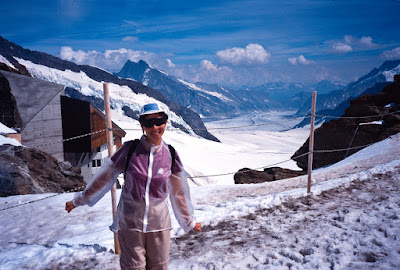
Between all those rests, it was about 12:00pm by the time we got into Grindelwald and found our hotel, the Hotel Tschuggen. We had booked the last room in the hotel the night before, and arrived in time for the owners to cheerfully check us in and put our tandem into their ski-locker (really a hut that looked more like an American-style garage). Our tandem safe and sound, we took a shower, grabbed our bags, and walked across the street to buy some more slide film, Lisa having shot almost all the slide film I had brought with us from the U.S. At the film place (where we paid $9 a roll for film that would cost $2.5/roll from a New York mail order store), the counter clerk told us that if we wanted to take the train to Jungfraujoch, we had better move quickly, since it’s a 3 hour trip and the next train would leave in short order.
We made a mad dash past crowds of tourists (it came as a shock to me to see so many Japanese tourists after not ever seeing one for the entire length of our trip thus far) for the train station and arrived there two minutes before the train for Kleine Scheidegg left the station. The train was a modern, electric cog-rail that motored along very quickly. I never saw the numbers on my altimeter move up quite so quickly. The weather looked perfect to be “on top of Europe,” and as we gained altitude the Grindelwald valley dropped away below us and gave us good views of town.
At Kleine Scheidegg, it was another mad dash for the ticket office to buy tickets, and then for the train up to Jungfraujoch. The cost of both train trips turned out to be about 290 Swiss Francs, which would be more than the cost of taking the train back to Munich fro Thun. On the other hand, the last time Lisa was in Grindelwald, she had such bad weather that it was obvious that there was nothing to see on Jungfraujoch, so we had to seize the opportunity while the weather was good. For more technical information about the trains involved, I refer you to Jobst’s Tour of the Alps.
By the time we got to the highest train station in Europe at Jungfraujoch, it was 2:00pm and we were both starving. Eating in the self-serve cafeteria, Lisa and I were amused to see the Japanese tourists on their packaged tours buzzing madly about, downing their coffees at tongue scalding speeds in 10 minutes and then leaving the cafeteria all at once, quiet and silent for both of us to enjoy our lunch in peace. We were happy to be independent tourists who could take our time and enjoy the scene. And what a beautiful scene it was, once we finished lunch and got out there. The sun was shining, and the vast glaciers and snow scene we saw was like being in the Antarctic, high mountains all around us and a sense of desolation in the snowy wilderness that makes one feel small. We were underdressed for the occasion, of course, but the excitement was high, and we hung around outside taking pictures from various vantage points until our socks were thoroughly wet and we felt a threat of frostbite from our toes.
 |
| From Tour of the Alps 2003 |
Once inside, removing our socks made us feel good again, but there was still plenty to do, from visiting the Sphinx observatory or admiring the ice sculpture museum that had been setup. By the time we left Jungfraujoch it was 3:30pm, and fog was blowing in over the mountain, obscuring the views. We left on the train feeling so lucky that we had had the opportunity to visit while the weather held up. On the way down, we met with two American tourists (an expatriate and a business traveler) who, upon hearing that we had bicycled through Germany, Austria, and now Switzerland, declared us quite insane. Insane or not, Lisa was now craving for some high quality shopping, so once we landed again in Grindelwald (and landing is the right word for such a train journey), we buzzed around the town in its varied shopping areas. Unlike other towns, Grindelwald’s shops stayed open until 8 or 10pm, though its internet access stores closed much earlier (at 5pm).
Dinner was at a restaurant down the street that advertised a vegetarian menu, but my theory about European vegetarian meals held up and I was glad I ordered a carnivorous dish when Lisa tried to wrestle her vegetarian meal down her throat. Trying to be vegetarian while bicycle touring in Europe is not a very good idea in general, as we were discovering on this trip. At this point, we were done with everything I had planned for the trip, so we discussed where we wanted to go next. Andrea and Frank had suggested the Italian Lakes as one of the most beautiful places that they’d visited, and I saw that Jobst does have it as part of his tour. Getting there would let us do Grimsel and St. Gottard pass at the very least, so I was as interested as well. With that in mind, we slept soundly in anticipation of more climbing the next day.
July 13th
(Grindelwald, CH to Handegg, CH, 72km, 1345m)
We woke up to an early breakfast, and then quickly packed our bags and headed “down the hill” towards Interlaken. In the cool morning air, the descent which paralleled the river was bracing but not so cold as to need warmer clothing, since we were not that high and were wearing long sleeve jerseys. The descent down towards Interlaken was deceptively fast, so much so that we got stuck behind the many cars also making the descent. There were also a few railroad crossings where we stopped and waited for trains to cross before proceeding, but by and large the kilometers rolled beneath our wheels quickly.
Soon, I saw a sign for “Interlaken Ost”, and took it, but that turned out to be a mistake—green backgrounds on blue signs indicate a freeway, where cars are allowed but not bicycles. In the morning on Sunday, however, that was not a problem, since there was very little traffic on the freeway and we only had one exit to go—a car or two honked at us to remind us that we were on the freeway, but police cars went right past us without stopping us or saying a word.
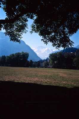 |
| From Tour of the Alps 2003 |
Fortunately, Interlaken was so small that once off the freeway, signs towards the center of town got us there in less than 10 minutes. From across the central meadow, we saw the Jungfrau as described in Jobst’s reports. We stopped at the tourist information center to ask about riding back to Innertkirchen. The lady at the desk told us that there was an official bike route to the South of the Brienzersee, but it had more climbing than the road to the North. Well, she said the magic 5 letter word, so we agreed to go to the South. The tourist information office gave us a map with a route out of town, but first, undeterred by her marathon shopping session the night before, Lisa wanted to do even more shopping. Well, someone had to watch the bike, so I put the bike down next to some benches next to the meadow and sat there for an hour, watching the world go by. This was downtown Interlaken, so in addition to the usual Dutch cycle-tourists and their huge panniers, I also saw horse carriages, tandem paragliders, and random tourists walking up and down the street.
We then headed out of Interlaken, along the river, which quickly gave way to the Brienzersee, a large lake on our left. The road quickly narrowed as we left Interlaken, then became a single lane road with trees lining the lakeside, affording us tantalizing views of the lake. Soon, we could see beaches, vacationers taking their rest under sun-shade umbrellas, and families on bicycles enjoying a beautiful summer afternoon. The beautifully routed bike path took us on a narrow paved trail above the tunnel which the road used, then dropped us dramatically into the town of Iseltwald, which we rode quickly through. The next part of the bike path bypassing the second tunnel, however, turned into dirt, which we took it easier on. The sparsely separated hikers were now becoming more and more frequently encountered, until we finally saw a sign which indicated that we had to walk our bike for the next 100 meters. Upon complying with it for about 20 meters we came to a beautiful waterfall which made it worth our while to photograph.
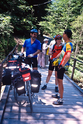 |
| From Tour of the Alps 2003 |
It was here, then, where we met Nam & Joel, a pair of cycle-tourists from near San Luis Obispo. Nam & Joel had come from Basel a couple of days before, and were looking to visit St. Moritz along the Sion valley. Joel carried a beautiful bike map of the Switzerland, complete with route numbers and deviations from the made roads—I had tried to obtain the same map from Omnimap but they were out of stock so I had made do with my 1:200,000 road map instead. On the one hand, the map indicated where bike shops are, among other things. On the other hand, the national bike routes were well marked and we never had trouble finding one if we really wanted one, so I’m not sure if I really wanted to have one. Nam & Joel asked the usual questions about tandems and tandeming, and we were happy to answer them. Upon hearing about our route and how we’d used up nearly everything, from Clif-bars to Cytomax, Nam & Joel donated some of their goodies to us, which we gratefully accepted. We had a good half hour chat before we parted, with us heading East, and them heading West, but part we did, albeit reluctantly.
I had hope to make the Lammi restaurant, but it was already past 1:00pm, and Lisa was feeling hungry. I’ve learnt not to argue with the stoker about food, so we had a bad lunch in Unterbach. Unterbach was a non-descript town along the bike path, but we did see a hand-cycle, and a tandem with a blind stoker coming by the other way, though they did not stop to chat.
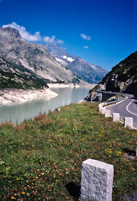
Leaving Unterbach, the bike path bypasses Meiringen, taking us into Willigen where the climb up Kirchet pass began again, this time from the other side. I had given Lisa a choice to either stay in Innerkirchen or Handegg, and she opted to climb up to Handegg so as to get to the top of Grimsel pass early the next day (and also avoid the hot weather in the valleys, which would make it difficult to sleep in an room without air conditioning). From Innertkirchen, the climb up to Handegg was not terribly interesting. It follows a river, but the road climbed away from the river quickly in the early kilometers, so we could neither hear nor see it. In Guttannen, there was a grocery store open (a surprise on a Sunday, despite Jobst’s reports) across the street from the town’s fountain (all European town fountains have potable water, unless signed otherwise), where we sat down and had ice cream. A cyclist rode by, saw us when he stopped for water, and then warned us that there was 11% grade up the top of Grimsel. We laughed and told him we were ok with that, since we were only going up to Handegg today. The grocery store owner told us it was only 6km away, so it was no big deal.
 |
| From Tour of the Alps 2003 |
Everybody lies to cyclists, as most cycle-tourists know, so of course Handegg was more than 7km away, up some fairly steep climbing. We reached Hotel Handeck after about 45 minutes or so to find that they were charging 180 Swiss Francs for a room. Further inquiry uncovered a cheaper room for 140 Swiss Francs, which we took, since neither of us felt like riding all the way to the top of Grimsel. The room was cool even without air conditioning, and had a TV with which we could watch a stage of the Tour De France. Of course, that kept us up late, which meant that we slept easily when we finally turned the tube off. All I remember was that Lance was in the yellow and that was good enough for me.
July 14th
(Handegg, CH to Airolo, CH, 50km, 1415m)
It was cool and refreshing after the heat of the day before by the time we left Hotel Handeck. A kilometer above the Hotel, a tunnel loomed before us, but this time, a cobblestone road led off to the right. Some road workers were repaving the cobbles, forcing us to walk past the construction, but we were soon riding along a quiet paved road with a beautiful view of the gorge below with its river. Upon resuming its connection with the road, the grade once again rose at its expected 11% grade, forcing us to slow down and grind along. This close to the top, however, we gained strength after every curve in the road, as we could now see the bottom of the dams as well as glaciers all around us. We didn’t hear many cowbells, however, and they were missed.
 |
| From Tour of the Alps 2003 |
Upon reaching the top, we looked once more on the backside of Furka pass and could see the Rhone glacier and clear blue sky all around us. The descent to Gletsch looked intimidating, but the traffic was light as the tourists had not fully arrived yet. Lisa sent off some postcards after we had some tea, and we descended down the backside of Grimsel pass into Gletsch. The descent was fast, though the hairpins kept my speed in check with frequent braking. By this time, the tandem and I were one, and with my clear sight-lines, I even over-took a motor-home going down the road at about 66.5kph.
We were in Gletsch at about 12:45pm, and stopped by the DFB to see if the antique train would take a tandem. When the answer came back in the affirmative, we asked how long it would take to run to Realp, and the answer turned out to be 1:30pm-3:30pm. What I should have done at that point would have been to ride down to Oberwald, where the next modern train would run us over to Realp in less than 20 minutes, but like a fool I took the antique train, which cost too much and took too long. Steam trains are polluting machines, and I didn’t enjoy the racket or the rattle very much, but the service was good and the views spectacular. The train, though, was late—arriving at 4:00pm.
 |
| From Tour of the Alps 2003 |
By this time, fog had started rolling in, and a stiff headwind rose up from the East to push us back towards Tiefenbach. But I was not to be deterred—I had unfinished business with St. Gottard pass. We stopped first at Hospental to get some much needed groceries and water from the fountain, and then left as soon as possible, starting the St. Gottard climb at 4:30pm. The grade was gentle and the climb sheltered from the wind, but we soon ran into some road construction. Fortunately, at a rest room break, a German cyclist rode up to us and told us it was only 2 or 3 km to the top, and that the “wind was stronger than the mountain.” I asked him if we should take the old road, as indicated by Jobst’s notes, but he said that wasn’t necessary—some local cyclists had said that the main road was fine all the way, except for a short section and nobody ever got a ticket for it anyway. He also told us that until the summit, there weren’t any tunnels, just slide protection galleries. The fog looked intimidating, however, but at this point there was no turning back—we rode into the fog.
 |
| From Tour of the Alps 2003 |
Climbing in the fog, even in the extremely light traffic because of the late hour, was a nerve-wracking experience for me. Barely able to see anything, we rode like that for a good 20 minutes before we saw the German cyclist and a few friends stopped at the top, in front of a lake that was barely visible in the fog, but not much else. We took a few pictures to commemorate the occasion, but then our Germans friends took off while we were putting on leg warmers. We then turned on our lights and headed down the pass. I could see very little—it was like riding in a cloud. To make things worse my lenses started fogging up, but I could not afford to stop rolling once we started building momentum—I couldn’t see well enough to check whether there was a shoulder. We rolled past a sign indicating the St. Gottard museum, and then faster and faster until we zipped right into a tunnel!
The tunnel was well lit, and I felt like I was in some sort of movie, diving into a black hole—tendrils of fog would reach out to touch me, but disappear as I moved within 2 meters of it. The eerie glow of the incandescent lamps inside the tunnel added to the spookiness of the scene, as I went as fast as I dared, not trusting my tiny tail-light to protect me from traffic behind me.
After a kilometer or two in the tunnel, we then burst out onto what Jobst calls a “flying-hairpin.” I didn’t know what a flying-hairpin was until this trip, so let me explain—it’s a buttressed aerial roadway that curves in mid-span like a typical hairpin. Since it’s an aerial structure, the feeling one gets is that of being on a glider, flying at speed around a corner, with views out on both sides AND below. We could see the mountains around us, the tunnel behind us, and the curved portion of the roads behind and in front of us, and even the buttresses that supported the road way underneath us—a truly exhilarating experience, especially since at that point visibility was restored to us as the fog dissipated. I had to remind myself that unlike California, this was not earthquake country, and the precariousness of my situation was only an illusion, as the road was built to Swiss standards.
Despite my best efforts at braking cautiously, we caught up to our German friends and played tag with them. I did not wish to over-take them, since I felt that having them near us provided some form of additional visibility—safety in numbers as it were. So together we rode in silence (for the wind noise was too loud to hear each other shout), at high speed in close proximity, for turn after turn until we got into Airolo, where they headed off towards their car and we searched for a hotel. The first hotel looked too expensive, but the second offered us rooms for 95 Swiss Francs. At 7:30pm, we did not bother looking further, so we took the room, ate a good Italian dinner (for we were in the Italian part of Switzerland), and after a nice walk around town went to bed. We were lucky to have run into the Germans, since we would not otherwise have taken the “cars-only” pavement instead.
July 15th
(Airolo, CH to Alabardia, CH, 99km, 460m)
We woke up early for a quick breakfast of bread, jam, and meat slices before heading out of town along the national bike route to Biasca and Bellinoza. As with the trip from Silvretta down to Bludenz, this was expected to be a mostly downhill trip. We rolled through quickly out of town and discovered at the first tunnel that our tail light wasn’t working. We stopped at the next town to buy toothpaste and new batteries, but naturally, didn’t need the tail light the rest of the day.
The bike route took us through a convoluted, but mostly scenic routes along the river, main road, and various historic small towns that looked very scenic. The day was overcast, making it perfect for photography. We made it into Biasca by 10:30 with the bike computers indicating that we had covered 48 kilometers in less than 2 hours. Biasca is said to have a well-stocked bike shop, so we stopped there to stock up on Cytomax replacements, but the shop mechanic thought that my shifter was fine, despite the fact that it wouldn’t index. Not having experienced the good indexing we previously had on the tandem, he thought that the cable was simply too long.
After a few attempts to get onto the bike route in Biasca (all of which was blocked by construction), we gave up and rode the main road into Bellinoza, having lunch on the way. It turned out that the Swiss bike routes ended at the train station in Bellinoza, though there were further signs onward to Locarno. We had ice cream and soup at the train station, enjoying the warm afternoon sun that would heat up rapidly past noon. After a long slow lunch, we rode through historic old-town Bellinoza, which had cobble-stone streets. On the way through I spotted a bookstore and we stopped long enough for me to go in and get a Kummerley+Frey map of the Piedmont region of Italy since my collection of maps were useless once we were in Italy.
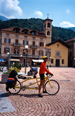 |
| From Tour of the Alps 2003 |
Following the signs to Locarno, we rode the bike route pass large fields of sunflowers, past campgrounds, and all sorts of signs that we could not decipher. I knew we had to get off the bike route at Gaggiole to cut across to Quartino, but had no idea where we were at any given moment. Fortunately, we stopped at an Interfood (really a discount supermarket of sorts) and when I asked where we were the cashier told us we were in Gaggiole and needed to backtrack a few hundred meters past the airport to get to Quartino. We were now solidly in Italian-speaking country, and neither German nor English was doing us much good. Seeing how cheap food was at this store, we quickly bought enough supplies for the next day and set on our way. We did get lost a few times circumnavigating the tiny propeller plane airport, but soon spotted cyclists coming the other way. Riding along the busy main street, we soon made it to Magadino, where we first saw the Lake behind a wharf of boats, and then we stopped at the tourist information center in Vira. Given the heat we were facing, I wanted a hotel with a beach so we could swim, and I was willing to splurge.
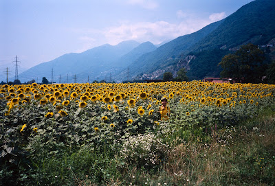 |
| From Tour of the Alps 2003 |
After Lisa made a few phone calls, we ended up with a hotel 5 kilometers just down the street, Casa C. We had to lock our bike outside in the driveway, but the private beach was secluded and very nice, and we spent a few hours swimming, lying in the sun, and sitting under the shade of the trees. Dinner was at a newly opened Pizzeria a short walk down the street.
That night, we pulled out our newly purchased map and looked at the options available to us. All connections through France looked dismayingly long to us—so following Jobst’s route was out of the question (especially since one of his cycling days was turning out to be more than two of our cycling days). We had two options—a return to Switzerland via Simplon pass, or Grand St. Bernard pass. A perusal of the OCD Swiss guide gave us the answer—while Simplon pass received poor reviews, Grand St. Bernard was said to be beautiful, a must-ride. We counted the days, and realized with a bit of dismay that we would have to skip the two recommended OCD passes in that area as well as market day in Luino in order to climb Grand St. Bernard on a Friday instead of a Saturday. (Having had that busy Saturday experience on Hahntennjoch pass, we were determined not to repeat it if we could help it)
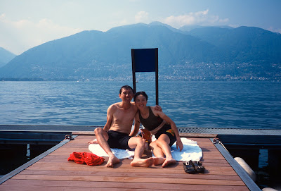 |
| From Tour of the Alps 2003 |
July 16th
(Alabardia, CH to Borgosesia, IT, 97km, 800m)
After breakfast, we headed south, heading towards the Italian border at Zenna. We were waved past the border, as was the norm for the EU. As we rode along, the open road gave way to tunnels and slide protection galleries. We found a few bypasses for tunnels, but by and large, due to constant construction, it seemed impossible to bypass all the tunnels and we just had to turn on our tail light and ride through most of them.
It was Wednesday, which was market day for Luino. Traffic was piled up for miles around town, but being on a bicycle, I could afford to be aggressive and use the other side of the double-yellow-line to overtake stuck cars, busses, and other sundry vehicles that clogged up the road. I thought I was being aggressive, until I was over-taken by a tiny Italian woman riding a motor-scooter. She weaved and dodged between incoming traffic and the stalled traffic in Luino like a skilled soccer player dribbling a ball past opponents, leaving inches of room between her and traffic on both sides. I tried to stay with her to take advantage of the opening she created in traffic, but it was in vain—she belonged in this environment, and I didn’t.
Past Luino, the traffic died off quickly, and we were left alone once more to enjoy our ride down the East shore of Lake Maggiore. From where we were last night, Lake Maggiore didn’t seem that big, but once on the Italian side of the border, we could now tell that Lake Maggiore was so large that we could not see both ends of the Lake at once. (Looking at the map, it looked like there were actually four ends of this oddly shaped body of water) It was only another 10 kilometers to Laveno, and once we climbed over the hill, we could see the ferries plying the water. The ferry left every 20 minutes from Laveno to Verbania, and cost less than 5 Euros for the two of us plus the tandem. Despite the customer in front of me paying her entire fare in 5 cent coins, we managed to get onto the ferry about a minute before the Ferry left. It was so hot and humid that it was a relief to find the air conditioned reception cabin, where we both bought drinks and sipped it in silence. The ferry ride was incredibly short—long enough only for that one drink, and soon we were down stairs again waiting for the ferry to open its jaws and let us out onto the mean streets of Italy again. (Take note, visitors—if you take any ferry other than this one from Laveno to Verbania, expect waits up more than an hour and an excruciatingly long ride—and check the schedule, as not all the other ferries run on all days)
 |
| From Tour of the Alps 2003 |
There was a group of touring motorcyclists on the ferry, and they mounted their bikes as well. Lycra and leather stared at each other for awhile, and then they raised their thumbs to us. Once the ferry made contact and the landing ramps were down, Lisa and I pulled out ahead of the motor vehicles and headed for the main traffic circle in town. There, the motorcyclists over-took us, waving and cheering, and we concentrated on following directions out of town. Somehow, we made the right turns and found ourselves on a quiet road with an open view towards the lake, benches to sit on, and a good place to park the bike. We did that, got cash out of an ATM, and proceeded to eat lunch, munching along while watching boats pass to and fro in front of us on the open water.
When we got on the road again, we rode to Fondo where we crossed the river to Gravellona, and started riding to Omegna, ignoring the signs for Lake d’Orta, which if followed would take you to the freeway. At this point I must acknowledge that having Jobst’s trip reports was of great help to me—we would have gotten lost a lot more often than we did if not for his excellent notes. Omegna sits on the North end of Lake d’Orta, a much smaller lake than Lake Maggiore, but not nearly as built up. We went on the East shore of Lake d’Orta, and rode past quiet roads and lake side views. The road was not entirely flat, but compared to the climbing we had done prior to visiting the lakes area was flat enough that we made good time, stopping for ice cream when we got so hot that we simply did not feel like continuing without re-fueling. (It was not just hot, it was humid as well—for 5 minutes after stopping I would have a face full of sweat!)
After our ice-cream we
began a climb around the south end of Lake d’Orta, where a couple of kids raced
our tandem up the hill (they won, of course, being fresh and unloaded with
panniers) into Gazzano. Gazzano was a maze of twisty cobblestone streets. Here
we began to feel rain drops here and there, but with the help of a few locals,
we were soon able to head out of town towards Pogno. Jobst describes the hill up
to Pogno as being short and steep, and he wasn’t lying, but the impending rain
(and occasional peals of thunder that we heard) gave impetus to our pedal
strokes and we were soon in Pogno where the rain started for real. We asked in
town if there was a hotel in town through gestures, but everyone shook their
head and pointed down the road to Valduggia. Having no other choice, we put on
our rain-gear and rode on up the road. Fortunately for us, the road led to a
canyon which was sheltered by chestnut trees which deflected most of the rain
from us. At the top of the hill past some abandoned water-wheel buildings there
was a summit tunnel which initiated the descent.
The
descent into Valduggia was wet, with our wheels at high speed throwing water
into our shoes and soaking our socks completely. At Valduggia there was a sign
that seemed to be of no help whatsoever in helping us find a hotel, so we rode
further down the hill into Borgosesia, where a kindly attendant at a gas station
told us to ride further down the street and look for the Garden Hotel on the
left. In less than 5 minutes we were there, parking our tandem in the lobby and
asking the receptionist if there was a room for us. He told us that the last
room in the building was available for 55 Euros, and we took it. On inspection,
however, we discovered that the main light in the room was broken, so we went
back down and he came up wearing a quizzical expression. It did turn out to be a
burnt out bulb, and after he made a few more funny faces he got the light
replaced. If the Hotel Garden was full, the hotel showed no sign of it—we saw no
other guests, and the lights were eerily muted, as though they were saving
power. It wasn’t until much later that we deduced that the hotel must have been
booked up by guided bus tours that would only show up much later, hence the
empty state when we found it.
Dinner was to be at a
recommended restaurant a little distance away in town, but before we got there
we discovered to our delight that Borgosesia was a large enough town that the
supermarket was still open at 6:00pm. We bought a few items, though that was not
without its travail—their cash register was broken and we had to wait while the
cashier attempted to fix it several times before giving up and finally switching
to a cash register at a different station. Italy was living up to its
reputation—the roads were always under construction, the drivers were crazy, and
nearly everything was broken. We then stopped by a bookstore and asked to buy an
English-Italian dictionary. This one had a blue cover and turned out to be
useless, at the restaurant and for the rest of the trip for that matter.
If
you are ever in Borgosesia and someone asks you if you’d like to go to a nice
restaurant or to a pizzeria, pick the pizzeria. The “nice restaurant” we went to
had great décor, beautiful silverware, but except for the pasta, the rest of the
meal wasn’t so good. I thought the pizza we had the night before was far and
away the better choice.
The
rain continued on and off all night, occasionally with thunder. But the
receptionist assured us that it was forecast to end by the next morning.
(Borgosesia, IT to
Montjovet, IT, 109km, 1370m)
It
was raining in the morning when we woke up and ate a non-descript breakfast, but
the rain stopped before 9:00am when we got on the road. Unfortunately, we took a
few wrong turns out of town before finding the sign for “Pray”, which lay on the
road up to Valle Mosso. We had fun taking pictures of the sign that said we were
going to “Pray”, and the short climb up to Valle Mosso wasn’t steep. The day
turned out to be quite nice, and we made good time to Valle Mosso and then to
Pettinengo. Unfortunately, we got a
little lost on the descent towards Biella, but once more with the help of local
cyclists we were put right—the ride into Biella was not much fun, however, since
it was along a main street that had quite a bit of traffic, and the day was
warming up.
Finally, when we
entered Biella, we saw a Chinese restaurant and stopped there for food and
directions. The couple running the restaurant was Chinese, and spoke Mandarin,
so we enjoyed ready conversation with them while we had a cheap lunch. Both of
them were from China, though they’d come into Italy separately and met there.
They had two young children and were grateful to make a living in Italy. They
mentioned that there’s a sizable population of Chinese in the country, since
apparently Italy was the most open of all the countries in the EU, but even then
there was no guarantee of citizenship for them or for their children no matter
how long they lived in the country. Even their kids who were born in Italy did
not qualify for Italian citizenship.
They were very
helpful, and pulled out an obviously worn and frequently used map of Biella to
help us get to Occhieppo, where we would leave behind Jobst’s route for a climb
recommended by the OCD as having superb views of the wine country into Settimo.
The route was not very obvious, but after committing the map to memory I was
confident that we would find it. We said goodbye to our hosts (who tried to give
us lunch for free), got onto our bicycle and rode off while their kids watched
us from the door of the restaurant.
The
route through Biella took us onto cobblestone streets for a little bit, over a
few bridges and rivers, and then onto an unmarked street for Occhieppo where the
climb started. Here, the traffic became minimal and it became quite possible to
enjoy the climb. However, 10 minutes into it we heard the same thunder that
preceded our rainstorm yesterday and then it started to pour. With the rain as
hard as it was there was no question of us continuing right then, so we found a
tree and stood under it while putting on raingear, and then waited. With such a
sudden and serious downpour we had hopes that it would blow over quickly, and
indeed, it wasn’t 20 minutes before the rain became manageable. Rather than stay
stuck under a tree all day, we decided to make a push for it.
Our
socks quickly became soaked, and started making squishy noises whenever we
pushed down on the pedals. Lisa also decided that she really didn’t like her
rain-jacket and asked to trade with my rain cape, so we found another shelter
and swapped our raingear and took off our socks. She loved the rain cape, and I
found the rain-jacket not so great but tolerable, so we proceeded once again up
the hill. The rain gradually diminished and soon we could not only shed rain
gear, but we could also see around us, now that we were high enough. Thin
strands of misty clouds had spread all over the valley below, creating a
beautiful artist’s light which could make us believe we were exploring a land
from the distant past. Houses around us were made out of stone and brick, and
the churches and other major landmarks were obviously constructed long ago out
of hewn stone and put together by hand. The weather got better and the grade was
gentle, even for a tandem.
From Ochieppo, the
road is signed first to Muzzarno, then to Netro and then Andante. At Croce Serra
(unsigned), the summit of the climb, there was a castle or some mansion that was
locked and closed to the summit. We stopped there for pictures but the
prevalence of mosquitoes ensured that we would not stay to explore. At Andante
there were no signs as to which road to take to Settimo, so we stopped to ask a
motorist which way to go. It was a good thing that we did so, because the
obvious road down (which did not pass through Andante) would have taken us
backwards to Ivrea instead. The motorist was so concerned about our ability to
find the road that she waited at the junction, and pointed out the road to us.
We thanked her and started down the road only to find that 20 meters ahead,
there was a fountain with cyclists drinking at it. With the weather once again
warming up, we had run out of water and took the opportunity to stop, refill,
eat fruits and chocolate, and chat with them. They were members of the Biella
bike club, out for a mid-week ride, and though they spoke no English, were happy
to try to communicate with us.
From Andante the road
wound around quickly, and sped on downhill, revealing to us a grand view of the
Aosta valley, the mountains beyond, as well as the river, main road and freeway
below. The view was breath-taking and the descent fast, though twisty and
narrow, with enough traffic to keep my speed-freak tendencies in check. At
Nomaglio, we ignored the signs elsewhere and headed for the signs to Settimo. At
first I thought we’d made a mistake, for the road started heading uphill, but
after a few rollers we reached Settimo and once again the descent started, this
time on a single lane road with hairpin after hairpin, each one granting us a
slightly different view of the valley to our left. While the turns necessitated
a slow descent, I was confident that the descent was short enough that we would
not have any rim heating problems.
Soon enough, we were
down on the main road heading North, with signs a plenty towards Aosta.
Fortuitously enough, we also had a tailwind, and after a bit of discussion, Lisa
and I agreed that we would push as far ahead as we could today, since every
kilometer we rode today would be one less that we have to make before climbing
the Grand St. Bernard pass tomorrow. Thus it was that we rode through Carema and
Donnas at about 30kph before stopping in Bard for ice cream. The area around us
was scenic country-side reminiscent of Napa and Sonoma Valley country-side, but
what really surprised us was that despite the four lane freeway just 500 meters
away from the main road, all the traffic through the area seemed to go right on
the main road. It was as though they built the freeway but the Italians
preferred to speed on the narrow main roads instead.
We
made another 12km at speed, and to Arnad and Verres, and then at Ploul, the
freeway enters a tunnel while the frontage road diverged from it and wound
lazily along the Dora Baltea river. With the tail wind getting stronger by the
minute, we barely noticed the slight upgrade, and before we knew it we were
rolling into Montjovet at 5:45pm. On a slight rise I spotted a steep upgrade
past the town, and looking down at my computer saw that we had already ridden
109km, the longest so far on the trip. I asked Lisa if she wanted to stop when
we saw the hotel in Montjovet and she gratefully accepted.
The
hotel in Montjovet was also the only restaurant opened in town on a Thursday
night (when the pizzeria closes). However, at 37 Euros a night, it was the
cheapest stay we had so far, and hence we ordered a big dinner and had a beer to
share before turning in for the night. Outside, the wind had changed direction
and was now coming from the North, which made dried our wet laundry hanging on
the balcony overnight despite the humidity.
(Montjovet, IT to
Grand St. Bernardo, IT, 69km, 2260m)
After an anemic
breakfast, we rode North against a light headwind towards Chatillon. Once past
the town borders, the road started a 10% grade up along a hillside. Fortunately,
despite our long day previously we were well rested and enjoyed the climb, which
provided a wind break. We quickly crested the hill and began a fast descent
through Chatillon, where the road turned towards the West and entered a
construction zone which forced us to stop and wait along with other traffic.
Past Chatillon, the
road once again began its gentle climb along the river, and the wind from the
North died completely, which enabled us to make good time. Every rise would be
followed by a gentle descent, which made for fun travel. The traffic was light
until we approached the outskirts of Aosta, where the road widened and became a
6-lane expressway. Aosta had the look of a tourist town gone mad like some of
the Western towns I’d seen near Denver Colorado. There were hotels and motels
everywhere, and along the expressway were fast-food chain restaurants like
MacDonald’s and other such. This was unpleasant riding but it did not go on for
more than 15 minutes before we spotted the signs for No. 27/T2, which was the
road leading up to Grand St. Bernard pass. We took the exit, which led to a
residential street where we stopped at the first gas station we saw to use the
rest room, eat some lunch, and swap our helmets for cycling caps.
Once past the gas
station, the road narrowed further and wound along houses that gave way to green
fields and great views of the valley to the East of us as we climbed past
Aosta’s city limits. The climb, while steep, was quite manageable and gave us a
shoulder with plenty of room. While big trucks were frequently seen on the road,
it was wide enough that the drivers could give us plenty of room when they
passed, and frequently there were two lanes in the uphill direction, so
automobile traffic usually gave us a lane’s distance. We stopped at Gignod for
water at a fountain and had some salad at the restaurant there.
After that, we made
good time to Etroubles and then St. Rhemy, where automobile traffic had the
option of taking the tunnel to bypass the Grand St. Bernard pass. I was relieved
to see that every truck took the option. The traffic lost almost all of its
density, and the road made its way first under a big overpass where we could
hear trucks and cars roar by before they entered the tunnel, and then ascended
into a beautiful pine forest very much reminiscent of the Sierras in California.
The forest provided beautiful shade and many turnoffs, enabling us to ride much
of the climb in relative coolness, and the turnoffs gave us many chocolate
eating opportunities.
As
the climb proceeded, it wove along the mountain in grand sweeping curves,
granting us first views of the valley below, then an amazing view of the road
above us, where it crested curve after curve. We heard cowbells once again, and
then wind chimes before the road leveled out at a café with a fountain right in
front of it. Pulling into the parking lot for ice-cold water out of the
fountain, we used the last of our powdered drink mixes and enjoyed the sound of
the wind-chimes and the spinners while tourists gazed at our tandem. This was
our last water stop before the top, and it turned out that Grand St. Bernard
pass wasn’t that far away.
The
pass came upon us as a surprise. Rounding 5 or 6 corners after our water stop,
we came around yet another curve in the road and there it was, a lake, a hotels,
roadside stands selling (what else) stuffed St. Bernards, the Italian border
office, and the sign proclaiming Grand St. Bernard pass at 2413m. Lisa asked if
we could stay at the Hotel at the pass, and it being about 5pm, I decided to
check at the Hotel at the Italian side. A bit of fussing around revealed the
price at 70 Euros for the night, which was not cheap, but on the other hand, not
bad given that we would have a cool night’s sleep and be able to descend Grand
St. Bernard’s pass the next day with little traffic. We checked in and the
tandem once again had the pleasure of staying in the wine cellar.
Dinner was at the
Hotel restaurant after the walk across the border (which closed at 6pm) revealed
the restaurants on the other side to be full of smokers and were not any
cheaper. At dinner, we met Rose and Bill, an American couple from Georgia, who
were traveling through Italy, France, and Switzerland on their own by car. We
had a good time having dinner conversation with them after they invited us to
share their table, and they marveled at the experience we had climbing passes on
our bicycles. (Car drivers, for instance, never hear cowbells, even if they have
their windows rolled down)
(Grand St. Bernardo,
IT to Bex, CH, 99km, 1075m)
The
morning started with breakfast in our room with some bread and juice/jam that we
bought the night before. After that, we quickly put on our warm jackets and
headed across the unmanned border into Switzerland. From there, the descent
started and what a descent it was. First, the hairpins gave us a view of Mt.
Telliers to our left and the lake Des Toules ahead of us. Then, at Bourg St.
Bernard (1915m), the road descended into a slide protection gallery that lasted
a good 10 km or so at least. It felt like one of those driving video games with
the galleries and outstanding scenery that we could see in our brief peaks in
between the pillars. Unlike the video games, though, we only had one life.
Even in the early
hours there was a surprising amount of traffic going up the hill, which in the
narrow galleries was quite scary. Fortunately for us, we were now dealing with
Swiss drivers, and they were all disciplined enough to stay in their lane for
the entire descent. We had very little traffic behind us, which gave me great
comfort and peace of mind on the descent, because it was not steep or twisty
enough for a tandem to outrun a car. (We did not exceed 69.5kph on the entire
descent, and most of the descent was well below 60kph)
Past Liddes, the slide
protection galleries gave way to views of the d’Entremont valley on our right
and the Ferret valley on our left, which were quite pretty, though we did not
notice it so much at that time for the road got a little steeper. We did not
envy the cyclists we saw climbing up the other way, for the traffic was heavy
going up the hill and the road narrow, if not as steep as the Italian
side—coming up this road from the Italian side was definitely preferable. We
stopped in the town of Orsieres for a second breakfast and tea, and then
followed the OCD recommended route to Champex.
This road is a jewel,
and for other tourists traveling the area I would highly recommend it in either
direction. It wound through a lightly used road past Orsieres in a series of
sharp hairpin turns that revealed views of the valleys around us, giving us
outstanding views of the Ferret valley as well as Mt. Dolent. If we had not
climbed this road we would not have appreciated how beautiful the area we had
just come through was. After about an hour of climbing, we reached Champex,
marked by a lake where tourists rented paddle boats and canoes or walked on the
shoreline. There, we paused for tea and desert before climbing our way out of
town and then started the steep descent to the outskirts of Martigny.
The
descent was also spectacular, so much so that to my regret, we stopped at the
first corner for pictures. The regret is not for the pictures as it was that
here we dropped our chain. No big deal normally, but further examination showed
that the chain had somehow made its way between the N-gear jump stop and the
frame, which meant that we had to first remove the water bottle cage in the way,
remove the N-gear jump stop, then lift the chain off and finally put everything
back into place. That operation took a good 20 minutes, and then we resumed the
descent.
The
descent was steep and also a single lane road. On a Saturday with semi-frequent
tourist traffic, this made for interesting hairpins where I had to peek over the
corner of the road onto the hairpin and check for open road before I dared to
risk taking the corner. In some cases I had to slow down almost to a stop and
let a car by before I could take the corner (which by necessity had to be a WIDE
turn). The frequent turns and the steep descent made me glad for dry road and
dry weather, but by and by we reached the intersection with the main road
without further incidents.
The
main road had plenty of traffic by this time but we spent very little time on it
before making it into Martigny where we found the cobblestone old town and had
lunch before moving into the downtown area. This was the French part of
Switzerland, so I had to remember my French from my last European trip so many
years before. Fortunately, as with all towns in Switzerland, the tourist
information center had someone who spoke English, and could tell us that the
best way to Aigle (our destination) followed the river, and could point out on a
map how best to get to the river. As usual, she could not help us make
reservations in Aigle, but at that time she assured us that we should have no
trouble finding lodging for Aigle was quite a touristy area and would have
accommodations for us.
Finding the bike path
along the river was not difficult as there was a national bike route following
the river. However, the Northern headwind that we had avoided yesterday came
back to haunt us today as we reached the lower elevations, and soon the cycling
became a chore. By the time we reached St. Maurice, Lisa was quite worn out, and
I was none too happy. At St. Maurice we stopped the bike in front of a fountain,
and Lisa sat there refilling her water bottle and drinking from it. When she was
done we decided to look for lodging, but the only hotel in town was charging 140
Swiss Francs and we were none too happy for it. We waited for the wind to die
down a bit, and after an hour or so when we were rested and the wind appeared to
lessen we went North once more.
The
wind had died down a little, but we’d lost the bike path in St. Maurice and
merely followed the sign into Bex. I asked Lisa if she’d like us to stop in Bex,
but in a bit of misunderstanding she’d thought that I had my heart set on Aigle,
and so she indicated that we should push on. By this time it was 5:00pm and the
fields around us were beginning to take on that golden look as the sun moved
slowly towards the horizon. The headwind was no longer as strong, but the road
started rolling as we moved out of one valley into another. The descent into
Aigle was fortunately quite nice but we made a few wrong turns following the
bike path signs (which turned out to lead nowhere) before finally giving up and
using the main road all the way into Aigle.
In
Aigle on a Saturday night in late July, everything gets booked up fast. We
discovered all the hotels were full, and were told that we’d have to backtrack
to Ollon or Bex to find something. Demoralized, we turned back and followed the
signs up the hill into Ollon, but despite a tough climb the one hotel was full
as well! So back to Bex we went. It was 7pm by the time we found the Hotel Le
Ceder at Bex which was a business hotel with plenty of rooms available, and
charged (you guessed it!) us a special rate of 140 Swiss Francs (reduced from
180 Francs), which at least included breakfast, unlike the hotel in St. Maurice.
Their restaurant was closed, but they recommended a good place elsewhere in town
which served a hearty dinner for an excellent price.
By
the time we got back to our room, we were quite tired and ready for bed, but the
hotel TV with Tour de France coverage managed to keep us up till 10:30pm.
(Bex, CH to
Gwatt-Zentrum, CH, 116km, 1685m)
We
started the day early, leaving the hotel by 8:00am to retrace our steps back to
Aigle, where we would climb Col des Mosses, a road described by the OCD as being
an uninteresting climb but a beautiful descent. The initial part of the climb
with several switchbacks one after another was quite unpleasant with lots of
morning tourist traffic. Fortunately, the traffic died down after 10:00am as we
gained in elevation towards Le Sepey.
Above 1000m, the air
got cooler and the scenery improved as we reached scenes that were textbook
images of Switzerland country side—barns, cows, roadside fountains and beautiful
two lane roads that looked so clean you could eat off the tarmac. By 11:00am
we’d reached Col de Mosses, which had a hotel restaurant and a street fair. We
decided to have an early lunch there and Lisa went shopping but could not find
anything she wanted to buy and then have to carry up our next pass.
The
descent from Col de Mosses was quite beautiful, following a gorge and dipping
between two hillsides into the pleasant and cool shade. At Chateau d’Oex, there
was a road closed sign which obviously did not apply to bicycles, so we rode the
road down the swift descent to the bottom, where a short hike along a hiking
trail took us to the parking lot of a campground and swimming pool with
convenient restrooms. Past Chateau d’Oex, the road followed a railway line to
Felndruz and Rougemont, but every meter of elevation gain between villages was
lost going into the next village. We eventually reached Saanen, where a roadside
café was open and the heat of the mid day called for ice-cream.
The
climb out of Saanen to Saanenmoser was neither steep nor pretty, but its
altitude granted us views of the Saanen valley and its airport. Once past
Saanenmoser, which was not high enough to enjoy cooler temperatures, the road
began to descend, at first steeply enough to keep up with the cars but soon
became too gentle to grant much speed. Swiss drivers were polite and
consistently competent as usual, but the heavy traffic was not very comfortable
and I soon regretted ignoring the bike route sign. We swept through Zweissmmen
and Weissenbach before finding the bike route sign again in Boltigen and taking
it. Running low in water at this point, we sought a fountain and soon found
one—unfortunately it had mud on the low side which I stepped on before getting
to it. The water was ice-cold and we enjoyed snacking before following the bike
route.
The
bike route did some gratuitous climbing before degenerating into a dirt road
which I was happy to ignore in favor of the nearby main road where the traffic
no longer seemed so odious now that I knew that the bike route wasn’t ideal. The
main road at least descended consistently and we could maintain speeds well
above 30kph all the way past Oberwill into Latterbach, where we stopped at a
roadside café to look for lodging. The road side café told us to take a side
street down to the hotel but the idea of having to descend and then climb back
up to the main road put us off so we went down into Wimmis instead. But before
Wimmis, the road forked off with a sign for Thun. When Lisa saw that Thun was
only 16km away she said, “Why don’t we just go all the way to Thun today
instead? Then we can stay some place for two days instead of having to pack and
unpack every day.” I relented and we kept going.
Finally, the road made
a big descent into Gwatt and the streets became quite busy. We stopped at a few
obvious hotels and asked for lodging but they were either full or asking for
ridiculous prices. We then followed signs for the train station. The tourist
information center was closed, but the train station had lodging listings. We
used up our calling card calling for places but finally found a place in Gwatt
Zentrum that was offering rooms at 90 Swiss Francs.
Gwatt Zentrum wasn’t
easy to find, but we did find it after asking at the gas station and found the
room while old, quite serviceable—especially since we were the only folks on the
floor. It was the kind of place where European tourists would stay for a week or
so, as opposed to a hotel that catered to Americans. The dinner was quite good,
and we would come back to the hotel for dinner the next day. As twilight fell,
we could see dark clouds and increasing winds surround the Thunersee, indicating
a storm for the next day, something I had read in the newspapers a couple of
days ago.
(Gwatt-Zentrum, CH,
65km, 480m)
We
woke up to rain pounding the roofs outside the building. Walking over to
breakfast in the main building, it seemed as though someone was throwing buckets
of water down the sky on us, but after breakfast it died down a bit. Lisa was
uncomfortable in the bed last night, so we asked for a room upgrade (to a 100
Swiss Franc room). For 10 more francs we got a much better room, but no place to
park the tandem—fortunately, the receptionist allowed us to park the tandem at
the same place we had last night, in a sheltered landing up a staircase where
the bike would not be easily seen.
We
debated whether to ride or to take the bus that day, but in the middle of the
debate the rain stopped, so we got on the bike and once again rode to the train
station, this time to buy tickets for tomorrow’s trip back to Munich. I found
out at the reservations office that we only had two choices of trains—a 7:15am
departure arriving in Munich at 2:00pm, or a 3:00pm departure arriving in Munich
at 9:00pm. I picked the earlier train, since we were hoping to get some last
minute shopping done in Munich, still. It took more than half an hour to arrange
the travel, since the booking agents had to reserve room for our tandem. The
cost—265 Swiss Francs, less than what it cost to take the train from Grindelwald
to Jungfraujoch.
After that, we went to
the tourist information office next door to ask about the a ride around the
Thunersee. Apparently, the northern portion of the route is all on roads, but
the southern portion has a bike path. When asked what the circumference of the
lake was, the agent told us it would take 4-5 hours. When we reiterated the
question they told us it was 50km, which wouldn’t take more than 3 hours, since
we had no panniers that day. Lisa asked for the locations of all the castles in
the area, since she wanted to see some Swiss castles.
We
rode away from the train station and over a bridge, following the signs towards
Interlaken. Right outside of Thun, we got beautiful views of the lake, with
boats tied along piers and ferries plying the waters. After we got off a few
pictures it started raining, so we once again put on our raincoats and moved on.
In Hunibach, we saw the first castle of the day and rode down to the parking lot
to park our bikes. It turned out that the place was closed on Mondays, but we
could still tour the castle grounds which we did. After the opulence of King
Ludwig’s castles, the Swiss castles seemed small, more like large mansions than
the estate of a King. The rain stopped just before we started off again to
Hilterfinger, the next town on the route and the site of a castle built right on
the water. We were struck out on this one too, since this place was open only on
Sundays! We did find a ferry landing onto which we could walk to spy on the
castle, which was quite impressive.
With that done, we
rode further along the lake past Gunten and Merligen, where the road stopped big
flat and began rising up above the lake. The rainy weather was obviously
reducing the amount of traffic on the road, since over-taking cars were
infrequent at this point. We pedaled along merrily, enjoying the open views that
our elevated position yielded us. Lisa spotted a ferry heading over to Beatus
Hohlen and we decided to see if we could beat the ferry. The ferry beat us by
about 2 minutes.
Past Beatus Hohlen the
road rolled down and then after a sharp curve climbed up again and the rain
started up. We pulled over to put on rain gear, and resumed the ride. The first
of 4 or 5 tunnels loomed up in front of us, but fortunately all of the tunnels
were quite short and after the first 2 the road turned downwards and we could
zip through all the tunnels at speed. At Unterseen, a town with one of the
largest campgrounds I’d ever seen, there were several lunch places but we decided not
to eat there, electing to see if there was a better place ahead of us. A fork
greeted us down the road past Unterseen where we had a choice to go to
Interlaken or towards Thun. Not wanting to do too much riding today, Lisa voted
for a ride strictly around the Thunersee, arguing that we had already been to
Interlaken.
At
the intersection, therefore, we turned right onto the national bike route
towards Thun, which paralleled a freeway and railroad before dropping down right
next to the lake. 5km down the road was Darligen, which had a pizzeria ready to
receive us for lunch just as the rain grew heavier. A very satisfying lunch
later, we waddled out into the sunshine and proceeded to wobble our way down the
bike path. It was clear that we were on a popular bike route, since we saw
family after family riding the other way, all on bicycles with panniers, even
the 7 or 8 year-olds.
The
road was level except just before and after towns, which made for quick cycling
despite the mild headwind. 11km later we were in Spiez where there was yet
another castle. This time, we rode right through the front gates only to have
the grounds-keeper yell at us, since bikes were apparently not permitted in the
castle grounds. We smiled and got off the bike. Unfortunately, it was getting to
be around 2pm, and Lisa would rather see the castle at Thun, so we did not stop
to explore this castle (there were no good places to lock the tandem anyway),
but moved on instead after we stopped at a stationary store for me to buy a
composition book.
We
made good time back to Gwatt and Thun, and got to the Thun castle at 3:00pm. The
Thun castle turned out to be a museum with an eclectic collection of historical
artifacts but had intact towers from which we could get good pictures of Thun
and its immediate environs. I spied a ferris wheel in the old town shopping area
and suggested a ride on it. Lisa said she’d rather shop first. We were quite
disappointed that the castle did not feature any historical information about
who had lived here and what purpose it served, but we did take a look at all the
exhibits and the views out of all four towers before departing for the old
town.
There, we locked up
the bike and while Lisa went shopping, I sat down at an outdoor café with a good
view of our tandem, ordered a coke, and started writing.
The next morning, after breakfast, they tried out our tandem
(Kerstin didn't like it, since she was used to having her own
controls), and then Beine led us to the train station and helped load
the tandem onto the train. With a heavy heart, we waved goodbye and
headed for the airport.
Summary: We had 1 bent
derailleur hanger at the start, a minor wheel truing in Bludenz, and shifters
that failed to index after 5 days or so, and no flat tires, which is pretty good
for a tour with 1501km (930 miles) of distance, and 22080m (72422 ft) of
climbing in which only 4 days required riding in the rain.
Shimano long (standard)
reach dual-pivot caliper brakes got their first touring test on this ride and
they came through with flying colors. At every point in the ride I had
confidence in them, and they were more than adequate for slowing a 300 pound
tandem from 60kph down to nearly nothing for the frequent hairpins on alpine
descents. The brake pads did wear down some, but did not need replacement on a
tour this short. Specifying these brakes was the single smartest decision I made
when I ordered the bike.
Robert Beckman panniers
on Bruce Gordon chro-moly racks once again earned their well-deserved
reputations as “the Mercedes Benz of racks and panniers.” Sigma Sport computers
front and rear were both accurate and made accurate record keeping a cinch.
Avocet 700x32 Fasgrip K tires wore excellently (even after 1000 miles much of
which was fully loaded we still have lots of wear left on the rear tire), and
handled well both on and off-road—the only places where we walked we saw
mountain bikers walk also. We experienced NO flat tires on this ride. I predict
that I shall be buying more of these tires for future tours, though we will go
down one size to 700x28 for local riding. Phil Wood Hubs gave us no trouble, and
the rear wheels only needed minor truing despite taking more abuse than we ever
put on our 26” tandem wheels, back when we had a 26” tandem.
Our Sunnto Escape 203
altimeter saw its tour debut this time and was a marvel of accuracy—I was
frequently within 10 meters of accuracy at summits, and the consistent altimeter
readings enabled us to plan rest breaks on long climbs, something essential on
long mountain roads.
Our big experiment this
time was to wear Pace-brand cotton cycling caps for long climbs. They worked
exceedingly well—those cotton cycling caps are the best sweat wicking devices
ever invented. At the top of every climb, the entire bill of my cap was
completely soaked. Now, I would never wear just a cotton cycling cap for a climb
in the USA, no matter how long, but in Europe with competent European drivers, I
wore these and no helmet up every climb with confidence.
Shimano’s bar-end
shifters worked exceedingly well, and even when they failed to index due to
corrosion, the friction mode continued to work, and I rode most of the tour in
friction mode.
Our custom-built Meridian
Cascade handled perfectly (you’ll need a custom-built tandem to use
standard/long reach calipers effectively). On and off-pavement, the bike was
stable, easy to handle, stiff, and so forgiving that I could recover from front
wheel slides on dirt, something desirable when fully loaded with panniers on
German bike trails which were more often dirt trails than not. The eyelets also
did not fail, which is a big plus compared to my last cycle tour.
German, Austrian, and
Swiss trains worked excellently for transporting tandems. I recommend them with
confidence. Swiss trains are not cheap, however, so I would not plan a long tour
centered around Swiss trains. They were very handy for emergencies, so all in all I
had a good experience with them.
Our Handspring PDAs
worked without a hitch for all days. We backed up our data religiously using the
Springboard modules designed specifically for that purpose. The occasions in
which we showed locals/fellow travelers Jobst’s “Tour of the Alps” reports for
their local area never failed to impress. (Whether they were impressed by my
geekiness or by Jobst’s extensive knowledge I don’t know)
This was my first tour
trying out Jobst’s “California Air” theory of tire inflation. Before putting the
bike on the plane, I pumped the tires up hard (to 110psi or so). Then, once on
tour, we did not pump up the tires or touch them up at all. The only time we
lost air was when Lufthansa (see “Things that failed”) let it out at the end of
the tour at the airport. Despite extensive curb jumping, off-pavement riding,
and many fast descents at speed, we had no issues whatsoever.
Not having an S&S
coupled tandem was great! We didn’t spend any time taking apart the bike or
putting it together, and the minor damage from transit took 15 minutes of time
to fix and cost 5 Euros. In retrospect I should not have bothered making
reservations for our first night and we should have stayed with our friends in
Munich instead, since the bike was in riding condition straight from the
airport, even with a bent derailleur hanger that I bent back by hand.
A year or two ago, we
discovered Lifeguard
Sunscreen. This alcohol-based sunscreen has turned out to be the best
sunscreen we ever used, since it doesn’t leave your hands or body greasy. It’s
gotten so much so that we dislike using any other kind of sunscreen. An 8 fl oz
bottle lasted as 15 days, and if only we’d brought more we wouldn’t have had to
buy yucky sunscreen.
We tried using “Hefty”
brand zip-lock bags instead of our usual Reynolds Oven Cooking bags, though we
did bring a backup supply of Oven Cooking bags. I have to say that those
zip-lock bags were terrible—the zip locks would fall out or fail to close after
a few iterations, compared to our 3 year old Reynolds Oven Cooking bags which
have survived multiple tours and backpacking trips.
Performance brand clear
rain jackets sucked. They did not provide sufficient venting and were too hot
for cycling. Whenever rain hit, Lisa would eye my Carradice rain cape jealously
until I gave it to her and wore her clear rain jacket instead. We’ll do our next
tour with two Carradice rain capes.
We brought along our
tandem talk intercom system in the hopes of using them on descents. They turned
out to be useless on long Alpine descents at speeds over 50kph. The sheer amount
of wind-noise proved insurmountable. They might have been usable for a long
climb, but on a climb we didn’t need the help from the tandem-talk. All in all,
the tandem talk proved to be a dud for a tour of the Alps, and were wasted space
and weight on the bike.
Lufthansa airlines proved
surprisingly ignorant of bicycles. They bent the rear derailleur hanger on the
way to Munich (an easy fix), and on the way back they insisted on deflating the
tires completely before taking the bike on the plane, though this time the bike
went through with no damage. My solution for next time is to use break-apart
derailleur cables and remove the rear derailleur completely for the flight (or
even just letting it hang), but at this point I will not recommend Lufthansa
airlines for tandem travel simply because they deflated the tires. A damaged
wheel would cost a lot more than 5 Euros to fix, both in terms of money and
time.
After too much rain
riding, our Cateye front light failed with a strange failure mode—it would drain
the batteries when turned off, but work fine if you put fresh batteries in and
turn it on. I’ll see if I can get Cateye to honor their warranty, but the unit
is cheap so it’s not a big loss.
We bought “Berlitz Basic
German”, a 3 hour tape course a month before the trip in the hopes of learning
enough German to get by. I wished the course was much more focused around
travelers trying to get by instead, providing scripted interactions at a
restaurant, or trying to get train tickets. In any case, a month wasn’t long
enough to get through the course, so we ended up learning to count (useful), and
knowing what a U-Bahn was (useful), but not much else. Cramming a 3 hour tape
course on the plane is also not recommended. We did end up buying an
English/German dictionary in Munich, which turned out to be quite useful. (The
yellow cover ones) The English/Italian dictionary we bought in Italy was however
quite useless. (There’s a theme here, in case you haven’t noticed)
Someone recommended the
Ultrapod mini-tripod to me before the trip. I bought one, and I’m afraid I found
it to be quite useless on the trip. Everywhere where I could use the tripod, I
could also find a flat surface to lay the camera down on. The tripod head was so
weak that even with as light a camera as the Olympus Stylus Epic, it could not
tolerate a vertical positioning of the camera. All in all, it was a waste of
money and weight to bring it along.
The best resource for the
area we explored was the British OCD’s Swiss Guide. The OCD (Ordre des Cols Durs) is the club for
folks who like climbing mountains on bicycles, with a special emphasis on the
Alps. All major passes are listed and indexed with descriptions, as are many
minor ones that are likely to be encountered on a tour. All passes described as
“beautiful” or similar adjectives were indeed discovered to be beautiful. At $5
for the Switzerland guide, this was definitely the “best value,” aside from
Jobst’s free trip reports. You can only buy ONE guide if you’re a non-member,
but members can buy as many guides as they like, and get a discount to boot.
Note that the Rough Stuff Fellowship also
publishes guides for the appropriate area, and their routes are also indexed in
the OCD guide’s maps. Given that I wasn’t primarily interested in off-pavement
riding this time (despite any appearances to the contrary), I did not contact
the RSF.
Jobst Brandt publishes
his annual “Tour
of the Alps” ride report. This was an excellent collection as I downloaded 5
of them to my Handspring for on-the-road reference. Complete with a description
of mountains, elevation, and special features to look out for, this is a
must-read for any tour planner. The downside is that Jobst has a terse style
that requires careful reading. He is also an exceedingly strong rider who has
toured the Alps every year, so don’t think you can get away with doing his tours
kilometer-for-kilometer (especially if you’re on a tandem), since you WILL lose
some time just by being unfamiliar with the area. In particular, we were
dismayed to find that it took us two and half days to cover the same distance it
takes him a day to cover. On the other hand, we’ve found his hotel
recommendations when he names them by name to be quite excellent, especially
Hotel Rosenlaui.
Kummerley+Frey maps at
the 1:250,000 scale were our main resources for our travels outside Switzerland.
We bought one for Voralberg/Arlberg, one for Bavaria (which we did not use), and
one for the Piedmont area Italy. For Bavaria, we ended up using the ADFC cycling
map of the area. While reasonable, I find that for a color-blind person the ADFC
maps are quite atrocious, as nearly everything is the same color, relying on
shades to distinguish bike trails and so forth. For Switzerland, we used the
Switzerland--Strassenkarte der Schweiz mit Namenliste/Carte Routière de la
Suisse avec Index des Noms (Road Map of Switzerland with Index of Names,
which were excellent in terms of elevation information, road information,
and city/town information. The actual Swiss cycling maps might be a little
better in that they include bike route information, but we found that we could
get onto the bike routes anyway since they were well signed. In any case, not
all bike routes were desirable, so I would not encourage excessive devotion to
the bike route, especially if you’re tired or in a hurry and are a good cyclist.
Most of these maps were purchased from Omni
Resources. I cannot recommend them from a customer service point of view
(their customer service is atrocious!), but unless you live near a map store no
one else really has a comprehensive selection of maps that you will want for
cycle touring.
We didn’t buy any guide
books because our local library
system had an extensive collection of guide books detailing the area in
which we traveled. In general, the Rough Guide to Switzerland was the best guide
for Switzerland, and the Lonely Planet guides to Bavaria and Austria were both
decent. We did not consult any guides for Italy as we didn’t plan to go there
when we first planned the trip. Overall, most of the English-language guides are
not cycle-oriented (most of them have a deep focus on cities/towns accessible by
train, and ignore everything between towns), so I consider them pretty useless
for a cycle-tourist who manages to get to a tourist information center before it
closes. We did get a chapter from “Germany
By Bike” faxed to us thanks to a fellow Hobbesian, but the directions in it
were found to be vague and not at all easy to follow. Given that we only used
the directions for 2 days, I’m not sure I would have paid money for the book if
I had to choose. I’d probably have brought along an extra map instead.
This was the most
expensive cycle tour I’d ever done, in costs/day or nominal costs. (I think
South Africa was still more expensive in terms of costs/mile) Airline tickets
from San Francisco cost $1000 each, and on-the-ground costs ended up being $3000
for the two of us, excluding film and processing costs (buying film is expensive
in Europe, so bring plenty—I brought 16 rolls of film and this turned out to be
insufficient—the scenery is so good that we shot 27 rolls in total). This worked
out to $75/person/day, much more than the $50/person/day that I managed on my
last European trip. This is accounted for in two ways: first of all, Switzerland
accommodations were expensive. We never managed better than 95 Swiss
Francs/night (approximately $80) for accommodations while in Switzerland, and
there were at least two occasions when prices jumped to 140 Swiss Francs/night
(approximately $100). Secondly, we took a couple of expensive train trips. The
trip up to the Jungfrau cost $220 for a day’s entertainment, while the train
trip back to Munich from Thun cost a similar amount (though less!). Given that
the Jungfrau trip was a once-in-a-lifetime experience, I do not begrudge it. For
a second trip, though, I’d probably plan around flying in and out of Zurich to
avoid the time consuming and costly train transfer.
There are cheaper
accommodations available. You can always camp, though for a tour of the Alps the
additional weight from a tent, sleeping bag, and sleeping pads might be
prohibitive and be enough of a drag that you might well rule out this
possibility altogether (we did!). A more intriguing alternative is “Sleeping
in the Hay”, which we found out about through some cycle tourists while in
Switzerland. We never did find out how easy it was to do this, since we didn’t
bring sleeping bags, but the price is right and if the network is extensive
enough, this may be a good way to reduce costs. This option lacks privacy,
however, which may be a deterrent for some tandem couples. On the other hand,
you will certainly meet much more interesting people at places like these than
at the usual hotels.
All in all, even though
Switzerland is expensive, as the OCD guide says: “No mountain cyclist’s career
can be considered complete without a visit to Switzerland”, so my best advice is
to just grit your teeth and bear the costs. There are cheaper places, but the
views, mountain beauty, courteous drivers, and good roads are well worth it.
Also bear in mind that supported tours of the same area cost $200/day/person at
best, so even at $75/day/person you’re saving well over 50% the cost of a
supported tour (and I’m not even talking about Santana’s $350/day/person luxury
tours), and having more fun to boot, since you’ll spend all your interactions
with local folk instead of with fellow Americans on your trip.
Of all the countries
toured, Switzerland had the best roads, best signed bike routes, best scenery,
and easily the best drivers. Austria and Bavaria had good scenery, excellent
bike routes (that are hard to find, and often unsigned), and good drivers. Italy
had the worst drivers, decent road surfaces, no bike routes, and scenery that
was excellent. Switzerland was most expensive, followed by Bavaria, then
Austria, with Italy being about the cheapest. If I’d gone straight from the USA
to Italy, I probably wouldn’t have thought much about Italian drivers, but
coming from the rest of Europe, I had to say that the Italian drivers left such
a poor impression on me that while a good friend of mine had almost persuaded me
to do an Italian tour prior to the trip, after this trip no amount of persuasion
would make me do a tour of Italy. I’d rather tour England, Wales, Scotland or
Ireland instead, or even California’s own wine country, which itself has rather
good riding, no language issues, and while busy on weekends is fairly car-free
on weekdays.
My big impression is that
this is the first tour where I feel like the scenery/riding is better than what
I got at home here in the San Francisco Bay Area. After returning to the Bay
Area, I went out for a 50 mile ride near my house, a ride that compares
favorably with New Zealand, Scotland, Southern France (in the Pyrenees). In
comparison with Switzerland, though—the road surface is not as good, the
mountains aren’t as high, the drivers rude, and the grass is indeed greener in
Switzerland (here in California the grass is brown in the summer), and I missed
the cowbells ringing in the hills. To make up for that we don’t get nearly so
much rain, and our passes are open all winter. Our mountain descents are also
more challenging, mostly because the road surface is POOR compared to
Switzerland’s big passes, and also because the road engineering isn’t anywhere
up to par with Switzerland’s. Switzerland’s hairpins turns, for instance, are
almost nearly level, while around here the steepest parts of a climb are on the
hairpins. As you can imagine, this makes cornering, climbing, and braking much
easier in Switzerland. As a matter of fact, if you can handle San Francisco Bay
Area climbs and descents, you are ready for anything you will encounter in
Switzerland.
3 pairs of cycling
jerseys and shorts each
1 pair “convertible
pants” each
2 t-shirts each
2 stuffed animals (1
each)
2 pairs underwear
each
Raingear
1 wind-shell each
1 warmer jacket each
1 pair summer gloves
each
1 pair cold weather
gloves each
Toiletries
Reynolds Oven Cooking
Bags for waterproofing
1 spare brake cable, 1
spare derailleur cable
Leatherman “wave”
multi-tool
Park allen wrench
2 spare tubes
Tire levers
Mt. Zefal HPx4 Frame
Pump
4 spare spokes
Spoke wrench
Rim tape
Pedal wrench
Spare bolts
3 large water bottles
Carradice saddle cover
for B-17
1 “camelback”-style water
carrier
1 Olympus Stylus Epic camera
2 Palm Pilots + backup
modules
26 rolls of slide film
(Kodak Elite Chrome 200, Fuji Velvia, and Fuji Sensia)
1 “Ultrapod”
mini-tripod
1 CatEye EL-300
headlight
1 Vistalite
tail-light
2 bungee cords (useful
for trains)
2 Robert Beckman
Panniers
1 Jandd expandable trunk
bag
6 clif bars
20 PowerGu Gels
3 small containers of
Cytomax powder
Total weight came to
about 13kg (including panniers)

From Tour of the Alps 2003 July
17th
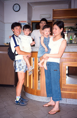
From Tour of the Alps 2003 
From Tour of the Alps 2003 July
18th
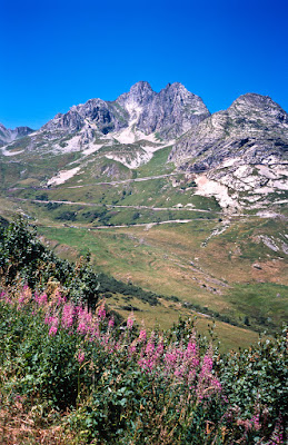
From Tour of the Alps 2003 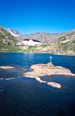
From Tour of the Alps 2003 July
19th

From Tour of the Alps 2003 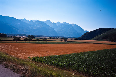
From Tour of the Alps 2003 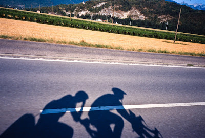
From Tour of the Alps 2003 July
20th
July
21st
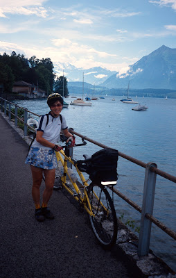
From Tour of the Alps 2003 Epilogue
Our trip back to Munich took us 6 hours the next day, with no
problems, though the train from Thun to Zurich almost did not have
room for all the bicycles. Upon arrival in Munich, we visited our
< a href="http://www.durchamerika.de">hosts again, and they took
us to a Biersgarten (Beer Garden) and showed us the good places to
eat. Kerstin and Beine had ridden their bicycles from Vancouver down
to the southern tip of South America, so they were strong, experienced
cyclists, and regaled us with stories from their tours.
Appendices
Appendix A: What Worked and What Didn’t
Things that Worked
Things that failed
Appendix B: Resources
Appendix C: Costs
Appendix D: Country Review
Appendix E: Packing List
Appendix F: Pictures
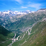
Tour of the Alps 2003